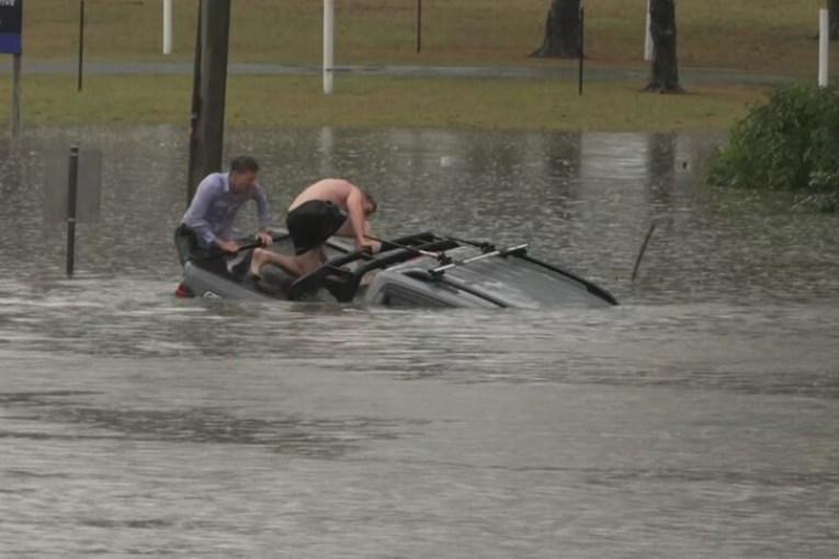
Bystanders rescue man from sinking ute in flash floods

Source: ABC
Intense storms have lashed south-east Queensland on Thursday, breaking October rainfall records and causing dangerous flash flooding — with warnings of more to come.
The intensity of the downpours took people by surprise as roads quickly went underwater.
In one dramatic rescue, ABC reporter Will Murray was involved in saving a man from a sinking 4WD ute, with only seconds to spare.
The man drove his grey dual cab at speed through water on Buchanan Road at Morayfield, north of Brisbane, the ABC reports.
The car stalled and started to sink with the driver still inside.
Footage shows two men wading in neck-deep floodwaters to the car and trying to find an opening to extract the driver.
One of the men tries to smash the rear windscreen with his foot. He then takes off his sodden shorts and continues the rescue effort in his underwear.
As the vehicle almost disappears, the rescuers pull the man out of the passenger-side door before it becomes submerged.
Later, the trio can be seen hugging each other with relief.
ABC camera operator Liz Pickering said the two bystanders “definitely saved that man’s life”.
The BOM issued weather warnings across the south-east on Thursday for slow-moving thunderstorms after a night of intense rainfall that dumped up to 168 millimetres in a few hours.
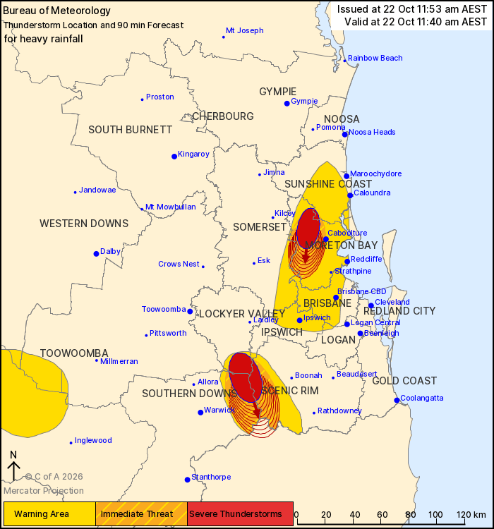
Slow-moving thunderstorms were forecast to hit parts of south-east Queensland. Photo: BOM
Meteorologist Angus Hines said the Caboolture area had taken the brunt of the rain on Thursday, with 200 millimetres falling over six hours.
Another area copping a drenching was Nambour, on the Sunshine Coast.
It followed a wet night on Wednesday in which nearly 170millimetres fell in three hours in some areas.
Some of the biggest falls were north of Brisbane, in the satellite cities of Caboolture and Morayfield.
Morayfield recorded 168 millimetres in the three hours to 7.30am.
Caboolture was hit by 159 millimetres in the same period.
Both towns were in the path of further thunderstorms expected to hit on Thursday.
In an update at 11.40am, the BOM said severe thunderstorms were likely to produce heavy rainfall that may lead to flash flooding during Thursday.
Locations which may be affected included Brisbane, Caboolture, Ipswich, Redcliffe, Nambour and Samford.
Weatherzone said numerous locations in south-east Qld and northern NSW received more than 100millimetres in the 24 hours to 9 am local time on Thursday, with several weather stations north of Brisbane receiving well over 200 millimetres.
The highest recorded 24-hour total was a massive 263 millimetres at the Caboolture Water Treatment Plant, just north of Brisbane, said Weatherzone.
“But the unfolding story of this severe weather event is not just the high 24-hour rainfall totals, but the sustained periods of intense rainfall which are continuing well into Thursday.
“After steady rain throughout the night, rainfall rates increased dramatically after dawn at many locations in and around Brisbane, especially on the Sunshine Coast.”
“This is the heaviest October rain in decades in several locations, and some records have already been broken.”
For example, Beerburrum (at the southern end of Sunshine Coast hinterland) registered its wettest October day on record with 170.8 millimetres.
The long-term average for the entire month of October is 81.4 millimetres.
Weatherzone meteorologist Jess Miskelly said the wet weather could persist until next Tuesday.
“During this time, peak storm days are likely to be Thursday into Friday and also Monday as surface troughs concentrate over the southeast Queensland region,” Miskelly said.