Rain brings bushfire relief, as heat persists for some
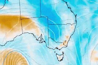
Source: Bureau of Meteorology
A bushfire raging for 21 days is finally contained, thanks to a cool change and rain bringing welcome relief for emergency crews.
The fire began on December 17 after dry lightning started multiple fires in the southern part of the Grampians National Park, in Victoria’s north-east.
On Monday, Incident Controller Peter West said while the fire was controlled, firefighters would patrol the area for weeks as they monitor the blaze and attend to any flare-ups.
“Coinciding with what is typically the busiest season for tourism in the area, the fire has resulted in considerable hardships and financial losses for local businesses and communities,” West said.
“Declaring the fire contained allows us to begin the process of reopening Halls Gap and areas of the national park.”
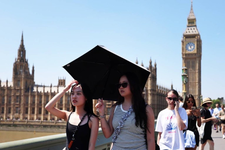
After a three-day heatwave that sent the mercury above 40 degrees in parts of Victoria, rain was expected throughout Monday.
By 9am Monday, the Grampians fireground had already received 10 millimetres, with as much as 25mm predicted.
A moderate fire risk rating remained, following days of extreme and high danger.
Victorian firefighters also battled blazes in the Central Goldfields region near Maryborough and at Moliagul, west of Bendigo, on Sunday, but were able to get the flames under control.
The Grampians fire remained at watch and act, although residents were finally allowed to return to their properties with caution.
Elsewhere, heatwave warnings remained for parts of NSW, northern Western Australia and north-east South Australia on Monday.
A high fire danger was forecast in Sydney and surrounding areas. Temperatures were expected to approach 40 degrees in the city’s west on Monday, meaning residents should be ready to act if there were fires.
Similar danger is forecast in NSW’s central west, southern ranges and north-western regions.
Meteorologist Miriam Bradbury said the hot, dry weather in NSW, with temperatures hitting the mid-to-high 30s and low 40s inland, would be followed by a significant temperature drop.
That cool change could bring showers, severe storms and flash flooding – with the heaviest rainfall expected in the north and central eastern parts of the state.
“Severe storms may bring heavy rainfall that could lead to flash flooding through the course of this afternoon and evening,” Bradbury said on Monday.
“As we move into Tuesday, we’re going to see that storm risk becoming a little bit more extensive across central and eastern parts of the state.
“With storms possible across much of the east coast, severe storms will once again be a risk but mostly covering parts of inland NSW.”
Wet and wild weather was likely to continue across NSW until Friday.
Grampians fire by the numbers
- Started by dry lightning, burning for 21 days before it was declared contained
- Fire footprint circumference of 422 kilometres
- More than 76,000 hectares of national park and agricultural land burned
- Four residential properties in Moyston and Mafeking destroyed along with 40 outbuildings in Moyston, Willaura, Willaura North, Mafeking, Pomonal, Glenthompson and Mirranatwa
- Preliminary livestock losses include 775 sheep, one horse, one beef cattle and 1285 beehives
- More than 13,538 hectares of farmland, including 10,053 hectares of pasture was burnt, and 540 kilometres of fencing was damaged.
Source: State Control Centre (Victoria)
-AAP
Want to see more stories from The New Daily in your Google search results?
- Click here to set The New Daily as a preferred source.
- Tick the box next to "The New Daily". That's it.