Flooding risk as heavy rain, winds batter three states
Source: Bureau of Meteorology
Multiple states are at risk of further flash flooding as a complex weather system batters eastern Australia.
Severe weather warnings have been issued in Queensland, NSW and Tasmania, with wild weather to continue on Thursday, the Bureau of Meteorology said.
South-east Queensland, including the Darling Downs, Wide Bay and Burnett regions, faces another day of heavy rainfall and unseasonal thunderstorms.
“In particular, severe thunderstorms are also possible through the Brisbane area and south-east coast,” the bureau’s Ilana Cherny said.
“Through these regions of Queensland, we’re not only looking at the risk of heavy rainfall, which could bring flash flooding, but there’s also the risk of damaging wind gusts and large hail.”
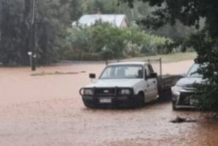
Brisbane was hit by severe weather on Wednesday, with many roads temporarily cut as rain hammered down from the north, with the city getting 43 millimetres by 8.30am on Thursday.
There were also significant totals in Queensland’s parched southern interior and Darling Downs.
In the state’s central west, 88 millimetres fell at Bungil Creek near Roma, while there was 68 millimetres at Rosewood. In good news for the region’s farmers, more rain was expected on Thursday.
There were much heavier falls in eastern Tasmania, with Gray copping a whopping 251 millimetres to 7am on Thursday and St Patrick’s Head getting 132 millimetres.
In St Helens, which had 61 millimetres, at least one business had to shut and another was sandbagging after water entered the building.
Severe thunderstorms and heavy falls will continue along the central and north coast of NSW on Thursday, with a severe weather warning and flood watch alert issued for the Hunter and mid-north coast.
Cherny said a broad low-pressure trough continued to suck in tropical moisture at the same time as a low-pressure system was developing in NSW.
The rainfall was most likely to contract to the NSW coast by Friday, but the heaviest falls depended on the unpredictable movement of the low pressure system, she said.
Rain is expected to ease over the weekend as the low moves offshore, creating hazardous surf conditions along the east coast.
Across the country, meanwhile, it is also wet. Perth got more than 18 millimetres of rain overnight to kick off a predicted streak of wet days.
A similar amount of rain is expected on Thursday, with showers expected to last throughout the weekend until at least Wednesday.
Forecaster Weatherzone said the Western Australian capital could get as much as 100 millimetres of rain in a week.
“Perth is expecting maximums a degree or two below the May average of 22.5 degrees from Thursday through to the end of the month on Sunday, then maximums of 18 degrees next Monday and Tuesday (June average 19.5 degrees),” it said.
“But the main story is the wet weather, which is always welcomed by most locals at this time of year.”
-with AAP