Stranded campers rescued as more deluges pound Qld, NSW

Source: Bureau of Meteorology
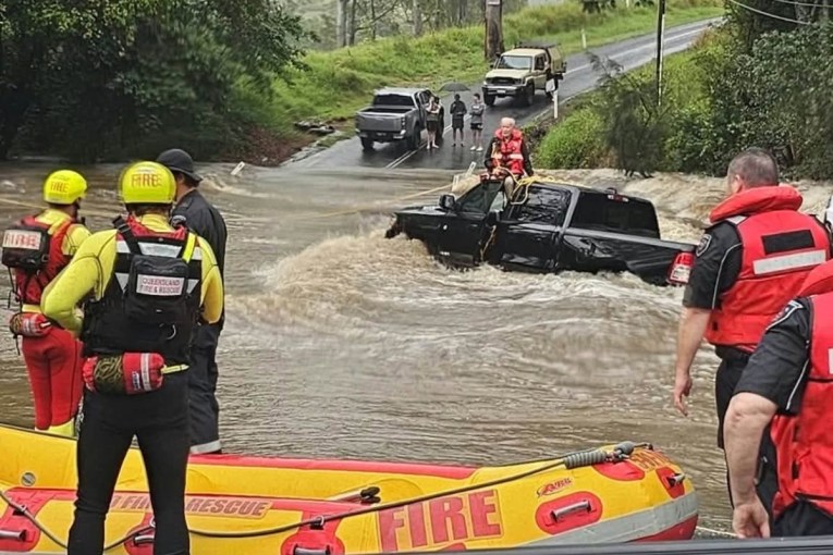
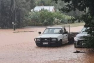
Six people have been rescued after getting stranded in floodwaters at a campground near Toowoomba as Queensland faces another day of torrential downpours.
Emergency services were called to the public campground at Leyburn about 7.45am on Monday to find three men aged 71, 47 and 26, and two 68-year-old women aged 68 and one aged 26 were trapped inside the grounds on Tullamaville Road due to rising flood water.
The Queensland Fire and Rescue Swiftwater crews brought all six to safety by about 11.15am. There were no reports of physical injuries.
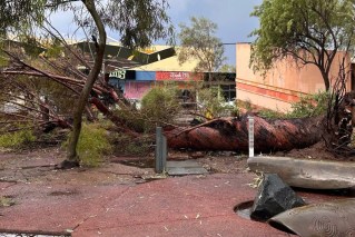
But it came as sodden areas of south-east Queensland and northern NSW face another pounding on Monday, with more damaging winds, hail and further flooding to come.
The Bureau of Meteorology has warned more storms are likely on Monday afternoon.
Queensland has been drenched in the past week, with some south-eastern regions getting more than 200 millimetres of rain, while parts of the Sunshine Coast hinterland have had up to 500 millimetres.
Blackdown Tableland, near Rockhampton, had 439.4 millimetres of rain to early Monday. Lower Springbrook, near the Gold Coast, got 325.2 millimetres, while Nambour, near the Sunshine Coast, copped 314.2 millimetres.
Brooweena, inland of K’gari, received 299.6 millimetres.
Flash flooding hit Laidley Creek and Glenore Grove in the Lockyer Valley, west of Brisbane, closing some roads, Queensland Police warned on Monday.
“Severe thunderstorms are possible … all the way from the mid-north coast and northern tablelands of NSW and up into much of south-east, central and even outback (0:44) Queensland,” weather bureau senior meteorologist Jonathan How said in a warning on Monday.
“Severe thunderstorms are likely … from about Coffs Harbour up towards the Queensland border, through the Darling Downs and out through parts of western Queensland.”
Severe thunderstorms were also possible for Brisbane, although they were more likely to its west.
“For south-east Queensland and north-east NSW today, severe thunderstorms could produce heavy rainfall leading to flash flooding, damaging winds as well as large hail,” How said.
“Further north, severe thunderstorms could produce damaging wind gusts as well as heavy rainfall.”
Storms that brought torrential rain had already delivered 98 millimetres in four hours at Tarome on Monday morning. There was also 75 millimetres in three hours at Upper Goomburra and 68 millimetres in the same timeframe at Millbrook, forecaster Weatherzone said.
“Some of Monday’s storms are likely to become severe, with damaging winds, large hail and heavy rain all possible,” it said.
“Conditions may also support supercell thunderstorms capable of bringing destructive winds (greater than 125km/h) and giant hail (greater than five centimetres diameter) over parts of central and southeast Queensland on Monday afternoon and early evening.”
The SES has also responded to 67 call outs since Sunday afternoon.
They included a woman who was rescued from her car after driving into floodwaters in Warwick at 3.25am on Monday. She was pulled to safety by officers.
Flood warnings are current for Warrill Creek and the Bremer River in the Lockyer Valley, the Macintyre and Moonie rivers in the south, and the Mary River near the Sunshine Coast.
Western Queensland also remains on alert, with warnings current for the Warrego River at Charleville, the Bulloo River in Quilpie and the Barcoo River at Blackall.
Thunderstorm activity was expected to peak on Monday after days of storms and heavy rain have left much of the region drenched. A cold front sweeping up from the southern states will bring even more instability to the atmosphere.
Once it has pushed through, however, there will be a short-lived reprieve before another round of storms next weekend.