Flood-hit NSW could cop another 300mm in days of rain
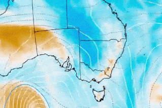
Source: BOM
Rain-drenched parts of NSW have been warned to brace for up to 250 millimetres more rain in the coming days after an “unusual” weather system already dumped more than 300 millimetres.
Weatherzone said a stubborn low-pressure trough that had triggered sudden and dangerous flooding in the Hunter region and mid-north coast could hang around for another two to three days.
Some districts recorded 200 to 300 millimetres over the past two days, forcing urgent flood evacuations as rivers broke their banks and took residents by surprise.
Some of the biggest rainfall totals in the 48 hours to 9am Tuesday included:
- 317 millimetres at Careys Peak (with 271 millimetres in 24 hours)
- 292 millimetres at Mount Barrington (including 268 millimetres in 24 hours)
- 283 millimetres at Taree Airport (with 279 millimetres in 24 hours and 166 millimetres in 6 hours)
- 243 millimetres at Port Macquarie (with 239 millimetres in 24 hours and 130 millimetres in 6 hours)
Emergency services performed 22 flood rescues overnight on Monday.
“A couple of the flood rescues we undertook were for people in houses in locations where water rose incredibly swiftly over their floors and they had to be relocated again, all brought to safety,” NSW SES chief superintendent of state operations Dallas Byrnes told ABC TV.
The SES received 2000 calls in the past 24 hours, responded to 1400 incidents, evacuated 60 people and performed 22 flood rescues.
Minor to major warnings for flooding on catchments across the mid-north coast and Hunter regions remain in place, while people in Taree are being advised to take shelter.
The SES has also asked people in isolated locations in the area to evacuate, including at Dungog, Paterson, Gloucester, Bulahdelah and Chinchester Dam.
“We are asking the community to be really, really conscious of their location … we are seeing lots of local creeks rise very quickly,” Byrnes said.
“We have had numerous rescues from people entering floodwaters (but) we’ve also done the majority from people who’ve just been in the wrong place, and flash flooding has taken them by surprise.”
The Bureau of Meteorology is predicting rain levels between 60 to 100 millimetres in six hours on Tuesday in parts of the mid-north coast and Hunter, increasing to 100 to 190 millimetres in isolated locations.
While damaging winds and surf are expected to ease later on Tuesday, the widespread is tipped to stick around for some days.
“Heavy falls will remain a risk, particularly across the mid-north coast, with flash and riverine flooding continuing to be the main concern,” BoM senior meteorologist Sarah Scully said.
“With large amounts of water building up over days and impacting roads and low lying areas, dangerous driving conditions, traffic and transport delays and detours are expected, and some local inundations will continue to occur.”
More than 30 schools will be closed on Tuesday in the mid-north coast, Central Coast and Hunter regions due to flooding.
The NSW education department reminded parents that schools do not offer minimal supervision during flood events.
Trains are not running between Scone, in the upper Hunter, and Newcastle.
Rain to continue for days
Weatherzone said the low pressure trough that was wreaking havoc was likely to linger near the coast for another two to three days.
“This near-stationary trough will continue to draw in moisture from the Tasman Sea and cause persistent rain over parts of the Hunter and Mid North coast districts and the adjacent ranges and tablelands,” said Weatherzone on Tuesday.
“In addition to the 100 to 300 millimetres that’s already fallen in the last 48 hours, parts of the Mid North Coast and Hunter could see another 100 to 250 millimetres between Tuesday and Thursday, with heavier isolated falls.”
Rain from this system is also likely to extend further south and west between Wednesday and Friday, soaking a broader area of NSW and the ACT, and even extending over parts of eastern Vic and Tasmania, Weatherzone predicted.
“A separate cold front should also deliver some rain to other areas of southern Australia from this weekend. ”
-with AAP
Want to see more stories from The New Daily in your Google search results?
- Click here to set The New Daily as a preferred source.
- Tick the box next to "The New Daily". That's it.