‘Stay indoors’: Warning for Sydney residents as wild storm hits
Source: Facebook/Steph Cooke
Sydney has been smashed by heavy rain after a massive line of dangerous storms caused major damage in inland NSW.
Suburbs across the city have flooded after up to 80 millimetres of rain was dumped in less than an hour on Monday.
Earlier, the storm smashed Harden, on the NSW south-western slopes about 330 kilometres from Sydney, bringing rain, wind and dangerous hail.
“Most shops are severely water damaged, our post office has smashed windows and leaks everywhere,” Hilltops Council member Michelle Gallo wrote on Facebook.
State MP Steph Cooke said the local Murrimboola Creek had flooded, inundating a playground, sports fields and surrounding amenities.
“The Harden SES has received dozens of calls since around 6am. Harden Fire and Rescue has also been busy,” she wrote on Facebook.
Gallo said the storm had left the town looking “like Canada”.
“Gutters overflowed, we’ve got water damage coming through walls,” she told the ABC.
“The road out the front was probably about knee-high, a metre under water and ice.”
Source: Facebook/Michelle Gallo
The storm, which hit about 6.30am, dumped 47.6 millimetres of rain at nearby Murrumburrah in just half an hour.
Later on Monday, Sydney copped its own lashing. The CBD had more than 40 millimetres of rain from 9am-12pm, while Horsley Park had 80 millimetres in less than an hour.
There was significant flooding at Cecil Hills, while Elizabeth Drive at Wallgrove Road on the M7, was under water.
The NSW State Emergency Service advised people in suburbs such as Hornsby, Parramatta, Sydney Olympic Park, Gosford, Mona Vale, Bondi Beach, Maroubra Beach and Terrigal to stay inside.
The warning was later downgraded, although people were advised to drive slowly and to stay clear of fallen trees, power lines and any damaged buildings. The waters off Bondi, Maroubra and Terrigal beaches were expected to be affected on Monday afternoon.
“The risk is not over yet,” weather bureau senior meteorologist Miriam Bradbury said.
She said a low-pressure trough over NSW was driving the stormy weather.
“That trough is helping to draw in moisture from the north and off the ocean, feeding it into any showers, storms and rain areas that develop,” Bradbury said.
It’s fairly stagnant, it’s not moving anywhere very quickly.”
Forecaster Weatherzone said heavy rain would develop along the NSW south coast from Monday afternoon. Another severe thunderstorm that was likely to produce heavy rainfall that may lead to flash flooding had been detected near Penrith and Warragamba.
Weatherzone said severe thunderstorms were expected to continue in NSW and north-eastern Victorian into Monday night, with another big storm day forecast for eastern NSW on Tuesday.
“Damaging wind gusts and large hail may also be generated by storms on and west the Great Dividing Range,” it said.
“Supercell thunderstorms may develop in the same area with the risk of life-threatening intense rainfall, destructive wind gusts and giant hail.”
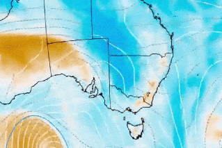
Source: Bureau of Meteorology
Further rain for FNQ
Flood-weary northern Queensland residents are bracing for more rising floodwaters as yet another deluge is forecast to hit the drenched region.
More heavy rain and flash flooding was expected to hit Queensland’s Gulf Country on Monday, with falls up to 250 millimetres in the next day.
A severe weather warning stretches from the Gulf Country across the tropical coast and down to the Burdekin region.
Between Tully and Ayr, including flood-hit regions such as Ingham, rainfall is expected to ramp up until Wednesday.
“This rain is falling onto saturated land, particularly along the north-east coast, as well as flash flooding, we may still see further river rises,” Bradbury said.
There are multiple flood warnings for major rivers across northern Queensland, including the Herbert River at Ingham, which reached beyond the 1967 disaster level last week.
It comes after a wet weekend with rainfall totals of 143 millimetres at Rollingstone on the tropical coast, 104 millimetres at Kowanyama in the state’s north-west, and 88 millimetres at Paradise Lagoon on Sunday.
There were more than 60 requests for State Emergency Service assistance in flood-affected regions in the past 24 hours, including tarping requests due to leaking ceilings, sandbagging requests due to groundwater entering homes, and resupply.
The persistent wet weather has hit regions already hit by flooding, marking more than a week since some towns were submerged.
Around 1900 residents remain without power across northern Queensland with Ergon Energy hoping to restore most services on Monday.
Meanwhile, Western Australia is bracing for a possible tropical cyclone that could form by Tuesday.
The warning zone stretches across 350 kilometres between Cockatoo Island and Bidyadanga, including Broome.
A cyclone watch has been issued between Cape Levesque and Degray, including Broome.
-with AAP
Want to see more stories from The New Daily in your Google search results?
- Click here to set The New Daily as a preferred source.
- Tick the box next to "The New Daily". That's it.