More severe storms predicted for southern Queensland with large hail, wild winds
Emergency services have issued warnings for residents as southern Queensland braces for more severe weather. Photo: Twitter
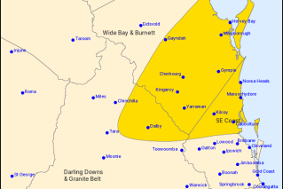
More severe thunderstorms are forecast for parts of Queensland on Saturday afternoon, with the possibility of damaging winds and large hail stones from the Gold Coast to the Wide Bay region.
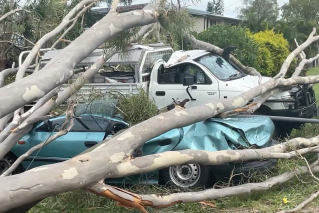
After a day of scorching temperatures, the storms on Friday night prompted almost 200 calls for help to the State Emergency Service (SES), for trees down and tiles off roofs, with 141 requests coming from the Gold Coast.
More than 45,000 homes lost power in Logan, the Scenic Rim and the Gold Coast at the height of yesterday’s storm activity.
Energex is still working to restore power to almost 24,000 properties, mostly in the Gold Coast hinterland and Beaudesert.
Spokesman Danny Donald said Energex was bracing for more storms on Saturday afternoon.
“The worst thing that we see is when we’ve just finished the whole two days of restoring power and another storm will come back and take out power again,” Mr Donald said.
“That’s what we hate – we hate it for ourselves and we hate it for our customers – so our crews are keeping their fingers crossed that this storm doesn’t eventuate, but if it does they’re ready to go.”
He said it could be Saturday night before service was restored to residents already affected by power outages from yesterday’s storm.
Mr Donald said crews were working hard, but there was a lot of damage.
“Poles ripped down and a lot of trees across powerlines and a lot of powerlines actually brought down, so while we aim to get the majority of customers up and running today, there still could be some of the worst-affected areas, particularly around the Gold Coast, Scenic Rim and Logan areas, that may be without power into this evening,” he said.
Severe thunderstorms are likely over parts of #SEQld today, with damaging wind gusts, large hail and heavy rainfall. Severe storms possible elsewhere across parts of inland and tropical #Qld ahead of a #dryline. Watch for warnings at https://t.co/OX1jP1sWL5 pic.twitter.com/CRRZvlmd4y
— Bureau of Meteorology, Queensland (@BOM_Qld) December 22, 2018
Wind gusts of up to 95 kilometres per hour were recorded at Wellcamp Airport near Toowoomba and the SES said at least two homes at Kalbar, west of Boonah, lost roofs.
Kalbar resident Sara Watson said Friday’s storm was the worst she had seen.
“The first 15 minutes was so scary; a historical greenhouse with all white timbers, that’s completely smashed down – it’s been up for about 110 years,” she said.
At Aratula, two people suffered minor injuries from a falling tree.

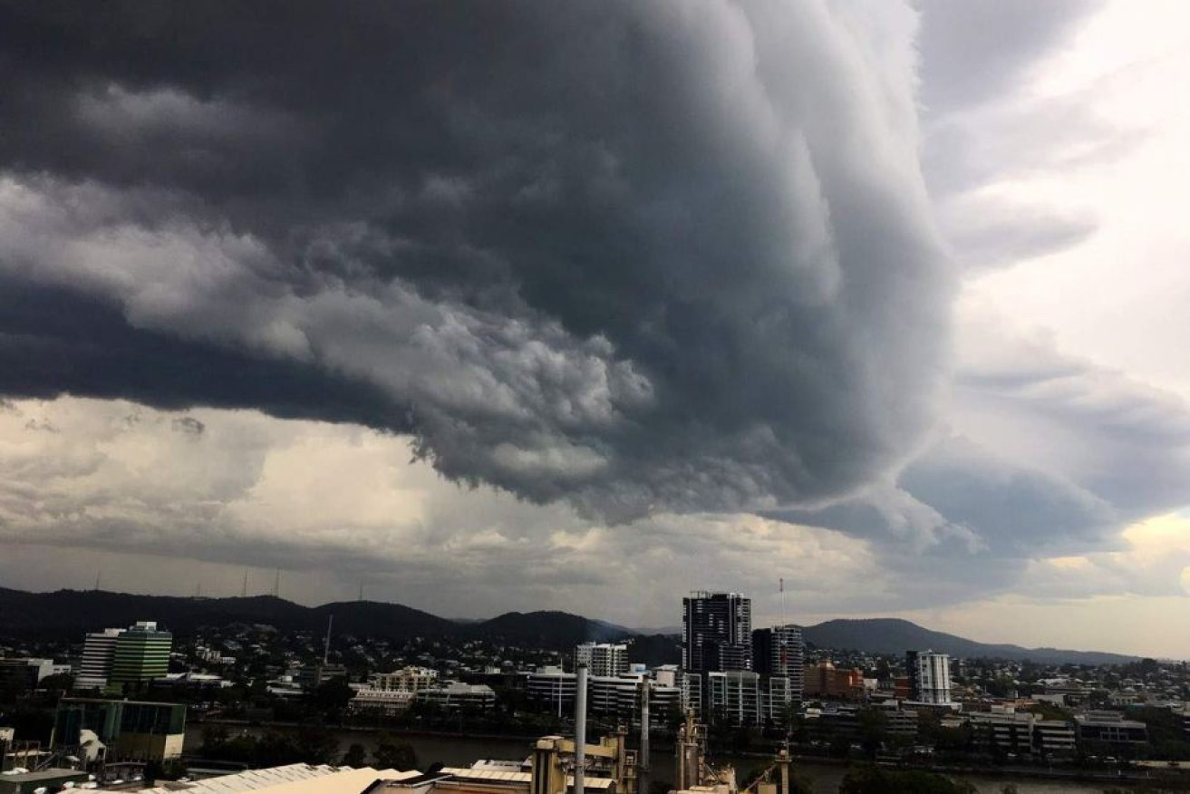
Storm clouds over Redcliffe, north of Brisbane, on Friday afternoon. Photo: Twitter
Hail possible Saturday afternoon
Bureau of Meteorology (BOM) forecaster Jess Gardner said a southerly change was moving up the coast on Saturday and likely to trigger severe storms for the Gold Coast, Brisbane, Sunshine Coast and the Wide Bay region.
“It’s looking like all the ingredients are there and there’s the possibility for hail,” she said.
“It is possible that we could get some severe storms, so we’re looking at some possible damaging wind gusts, possible large hail, so we would definitely urge people to keep an eye on warnings.”
Ms Gardner said it would also be hot again today, but temperatures are set to moderate from Sunday.
She said unlike Friday’s storms, Saturday’s activity was forecast to produce cooler temperatures.
“With the southerly change, while it’s bringing storms through today for the south-east, behind it, it’s got a much cooler and much more stable air mass, so we will see so those temperatures drop around Brisbane,” she said.
“We should see them drop tomorrow, so [we are] expecting temperatures in the high 20s rather than the mid-30s.
Ms Gardner said the storm activity would also bring cooler temperatures that would last into next week.
“Also making quite a difference is that the air mass is quite a lot drier so there’ll be a lot less activity – no storm activity expected, maybe a few occasional showers,” she said.
“That humidity will drop as well so it’ll be much more comfortable for the Christmas period.”
-ABC