Flood warnings as NSW, Qld face yet another deluge
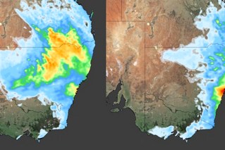
Source: Bureau of Meteorology
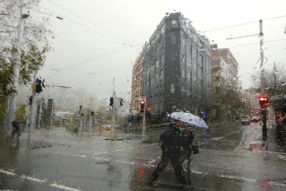
Already sodden parts of NSW and southern Queensland are in for further deluges in coming hours, prompting widespread flood warnings.
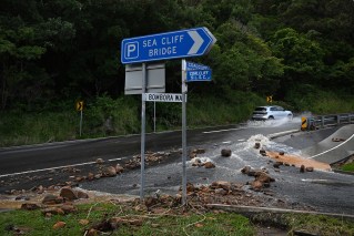
The weather bureau has issued a warning for localised heavy rainfall for the NSW South Coast and Illawarra at the weekend.
It follows downpours bringing double the monthly rain average to some areas in NSW, Queensland and Victoria in the past 24 hours.
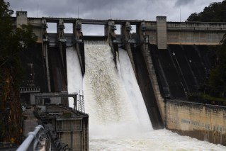
There are also fears Sydney’s Warragamba dam, which is at near capacity, could spill in coming days – bringing a flood threat to those downstream.
Forecaster Weatherzone said the first nine days of May had been very wet for much of NSW and south-east Queensland.
“Coastal NSW and far south-east Queensland have picked up 100-200 millimetres during May so far, and inland areas of NSW have seen 25-100 millimetres fall,” Weatherzone said on Friday.
“The rain and thunderstorms will continue in south-central Queensland, western NSW and north-central Vic on Friday, before shifting east on the weekend with the upper trough.”
Falls to Friday morning included more than a month’s worth of rain at Broken Hill, NSW (23.8 millimetres), and Thargomindah, Queensland (26.2 millimetres). In central Victoria, 41.4 millimetres fell at Mangalore airport – its wettest May day in 24 years.
Later on Friday and into Saturday, large rainfall totals are expected along most of the NSW coast and in Queensland’s south-east. The heaviest falls are forecast for the South Coast, Illawarra and the eastern Southern Tablelands, with daily totals of up to 100 millimetres likely.
“The rainfall in these areas could be quite heavy, with six-hourly totals of 70-90 millimetres, while some areas could pick up 120 millimetres in six hours,” Weatherzone said.
“This rain will be falling on an already sodden landscape after last week’s rainfall, which could increase the risk of flooding.”
The Bureau of Meteorology has warned of heavy rain, and potential flash flooding, in those areas into early Sunday. It is expected to ease after that.
The forecast includes a likely 35 millimetres in the catchment of the Warragamba Dam, which is already at 99 per cent capacity.
“Modelling based on bureau forecasts indicates that Warragamba will spill, though the exact timing and volume will depend on catchment rainfall and the resulting inflow to the dam,” Water NSW said on Friday.
“The community should continue to monitor advice on river levels and any flood warnings from the Bureau of Meteorology.”
The Warragamba Dam catchment area covers 9000 square kilometres, stretching across much of the Blue Mountains to Goulburn in the south, and to Lithgow in the north.
The dam – Sydney’s largest – has spilled more than 50 times since 1960.
It last spilled after heavy rain in April. Water NSW said this weekend’s event was likely to be at a lower level.
Other smaller dams in greater Sydney are also likely to continue to spill. The include Cataract, Nepean, Woronora, Tallowa, Greaves Creek, Medlow Bath, and Middle Cascades, as well as Avon.