On the road in Ireland to explore the Ring of Kerry

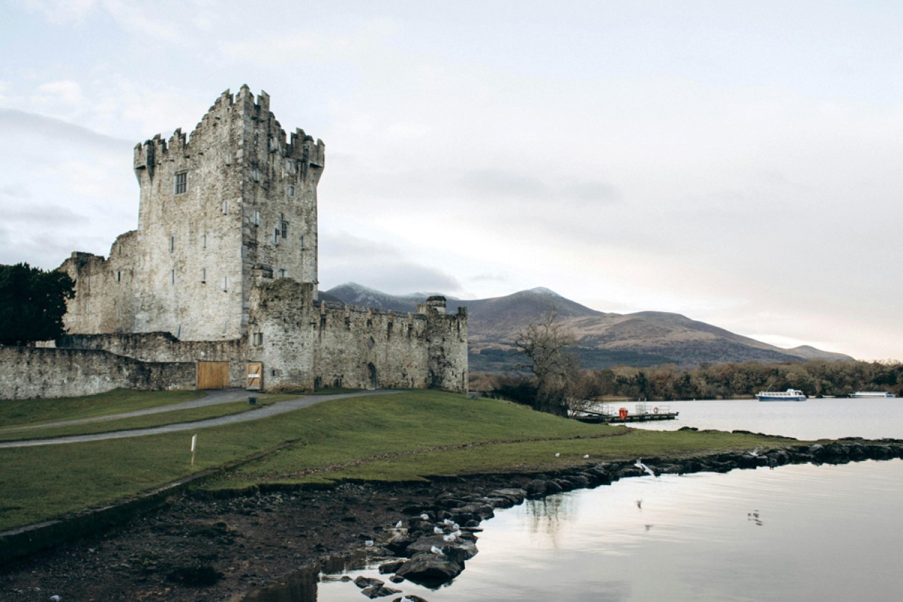
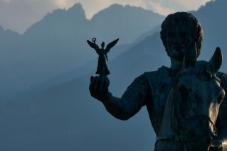
Waiting for elves at Ross Castle. Photo: Pexels.com
Kerry. This county in south-west Ireland, nicknamed “the kingdom”, conjures up images of green meadows dotted with sheep, untamed coastlines, ruined castles and mysterious lakes.
I reach this dream land from France via Cork, having to adapt to driving on the left as soon as I get off the ferry. Despite initial concerns, it’s easier than I imagined, and the 100 kilometres or so that separate me from my destination, the Iveragh Peninsula, allow me to familiarise myself with this unfamiliar side of the road.
My plan is to travel clockwise around the famous Ring of Kerry, a 180-kilometre circuit that loops around the Iveragh Peninsula, before continuing on to the Dingle Peninsula.
First stop is Killarney National Park, a UNESCO World Heritage Biosphere Reserve which, at 10,000 hectares, is the largest tract of wilderness in Ireland.
I pick up a map at the visitor centre and make my way to the car park and the trailhead for hikes to the Gap of Dunloe. This magnificent valley is accessible only to pedestrians, cyclists and horse-drawn carriages. A narrow path runs alongside a succession of lakes, sometimes crossing them with small stone bridges, such as the pretty Wishing Bridge.

Beyond Augher Lake, the valley narrows. I follow the zigzagging path up to the pass, surrounded by sheep bleating as if to encourage us hikers on. At the top, a beautiful view unfolds, encompassing the Black Valley and Carrauntoohil (1040 metres), Ireland’s highest peak.
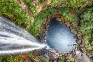
Back in the camper, it’s on to Ross Castle, a 15th-century fortress on the banks of Lough Leane, then Torc Waterfall, hidden in lush vegetation – I expect to come across elves at any moment. Passing Derrycunihy Church, I reach Ladies’ View, looking out over peat bogs and Upper Lake.
At Moll’s Gap crossroads, I choose to turn right onto the R568 and stop just a few hundred metres later in a car park on the banks of Lough Barfinnihy. The silence is total, the surface of the water sparkles – a perfect place for lunch. Taking your time and getting off the beaten track often leads to the discovery of breathtaking landscapes like this.
The drive continues on the Iveragh Peninsula, a place where you can’t help but drive slowly to appreciate the natural wonders around you – and because the roads are rather narrow.
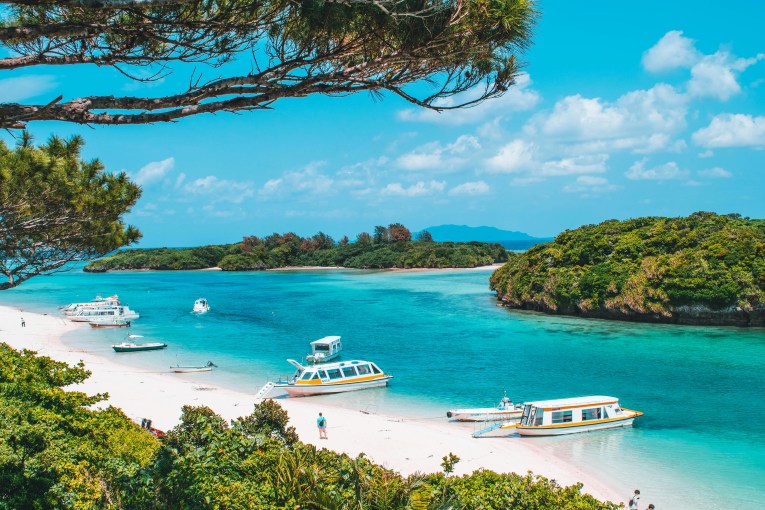
Sneem, a typical Irish village with colourful houses and pubs, is where I rejoin the N70 and go south-west for 23 kilometres. Out in the Atlantic are the islands of Scariff and Deenish. I park at Derrynane Beach whose white sand, turquoise water and green hills combine to make a heavenly setting. The ruins of an abbey on a small island are accessible at low tide.
Shortly after Waterville, I momentarily leave the Ring of Kerry
for the Ring of Skellig, a beautiful 18-kilometre circuit that follows rough cliffs and is known as a Gaeltacht stronghold, where Irish Gaelic is spoken. You can see the Skellig Islands, two rocky peaks, one of which is home to an abbey. Boat trips are available to get there, usually from Portmagee, but as the day is drawing to a close, I opt to head back to the Ring of Kerry and a campsite I’ve reserved at
Cahersiveen.
I lie on my bed and read a book facing the ocean. When I wake up, drops of water are beading on the windows. The insulating curtains I use aren’t enough to stop night-time condensation caused by high humidity and the temperature difference between inside and outside. So, as always, I make sure to air out the van before setting off for the day.
My last stops on the Ring of Kerry are the Rossbeigh lookout, a sandy outcrop in Dingle Bay, and the Kerry Bog Village Museum, a reconstruction of a 19th-century village typical of this peat bog environment.
I’m now heading for the Dingle Peninsula. Also in County Kerry, it marks Ireland’s most westerly point. The R561 runs along its southern coast, taking me to the immense golden sands of Inch Beach, stretching five kilometres into the bay. From here, I continue west to the charming coastal town of Dingle. A statue has been erected in tribute to the local mascot, Fungie, a wild dolphin who lived in the bay for almost 40 years.

Turquoise waters and white sand at Derrynane Beach. Photo: Unsplash
I start the Slea Head Drive, a 50-kilometre circuit that crosses empty valleys, skirts sea-worn cliffs and reveals beehive huts, the Gallarus Oratory (looking like the upturned hull of a ship) and so many other beauties.
Aboard my home on wheels, I extend this wonderful trip at Conor Pass to admire the view of lakes, moors, bays and Mount Brandon. Very quickly, the narrowness of the road means there’s no turning back or overtaking. Hands gripping the steering wheel, I break out into a cold sweat, hugging the edge of the vertiginous precipice and waiting on the left-hand side of the road as soon as I spot an oncoming car. Fortunately, traffic is light and the driver behind me is patient.
I’m so focused that I’m not even enjoying the glorious panorama. It’s not until I reach Peddler’s Lake car park that I relax – before spotting a road sign stating that this stretch of road is not authorised for vehicles weighing over two tonnes or wider than 1.8 metres. Oops.
Luckily, the final push to my ultimate destination, Tralee, is less
traumatic.
This is an extract from Lonely Planet’s Epic Van Trips of Europe. $55 RRP. Contact shop.lonelyplanet.com
Want to see more stories from The New Daily in your Google search results?
- Click here to set The New Daily as a preferred source.
- Tick the box next to "The New Daily". That's it.
Aussies’ top 10 winter island getaways revealed
Mount Olympus tipped for heritage list
NSW’s 10 most visited national parks revealed