Flooding as Hurricane Barry makes landfall in US
Hurricane Barry has made landfall in Louisiana as authorities keep watch on flood levels. Photo: AAP
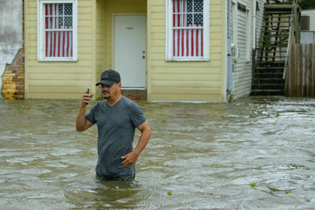
Hurricane Barry has rolled into the Louisiana coast, flooding highways, forcing people to scramble to rooftops and dumping heavy rain that could test the levees and pumps that were bolstered after Hurricane Katrina.
After briefly becoming a Category 1 hurricane, the system quickly weakened to a tropical storm as it made landfall on Saturday local time near Intracoastal City, Louisiana, about 260 kilometres west of New Orleans.
Its winds fell to 110km/h, the National Hurricane Center said.
However officials warned that Barry could still cause disastrous flooding across a wide stretch of the Gulf coast.
“This is just the beginning,” Louisiana Governor John Bel Edwards said.
“It’s going to be a long several days for our state.”

Stephanie Barlow and her daughter June Barlow, 1, wade through storm surge in Mandeville, Louisiana. Photo: AAP
Barry was moving so slowly that heavy rain was expected to continue all weekend, with predictions of up to 50 centimetres through Sunday across a part of Louisiana that includes New Orleans and Baton Rouge.
Some places might get 63cm.
Forecasts showed the storm on a path toward Chicago that would swell the Mississippi River basin with water that must eventually flow south again.
The coast guard rescued more than a dozen people from the remote Isle de Jean Charles, south of New Orleans, where water rose so high that some residents clung to rooftops.
None of the main levees on the Mississippi River failed or were breached, Mr Edwards said.
But water was pouring over a levee in Plaquemines Parish, south of New Orleans, where fingers of land extend deep into the Gulf of Mexico.

Water breached the top of a levee in Plaquemines Parish just south of New Orleans. Photo: AAP
Oil and gas operators evacuated hundreds of platforms and rigs in the Gulf of Mexico.
More than 70,000 customers were without power on Saturday morning, including nearly 67,000 in Louisiana and more than 3000 in Mississippi, according to poweroutage.us.
During a storm update through Facebook Live, National Hurricane Center Director Ken Graham pointed to a computer screen showing a huge, swirling mess of airborne water.
“That is just an amazing amount of moisture,” he said.
“That is off the chart.”
https://twitter.com/theconnectedk/status/1150117499540840448
The river crested on Friday night at just under 5.18 metres in New Orleans, the National Weather Service said.
It was much lower than a prediction of 6.1m earlier this week, which would have approached the height of the levees.
The river was expected to surge again on Monday at about 5.18m, up slightly because of the expected rains, the weather service said.
The “lopsided” nature of the storm meant most of the rain was expected after landfall and its slow speed increased the risk of flooding.
-with AAP