Lincoln logs a course across the Top End for Kimberley
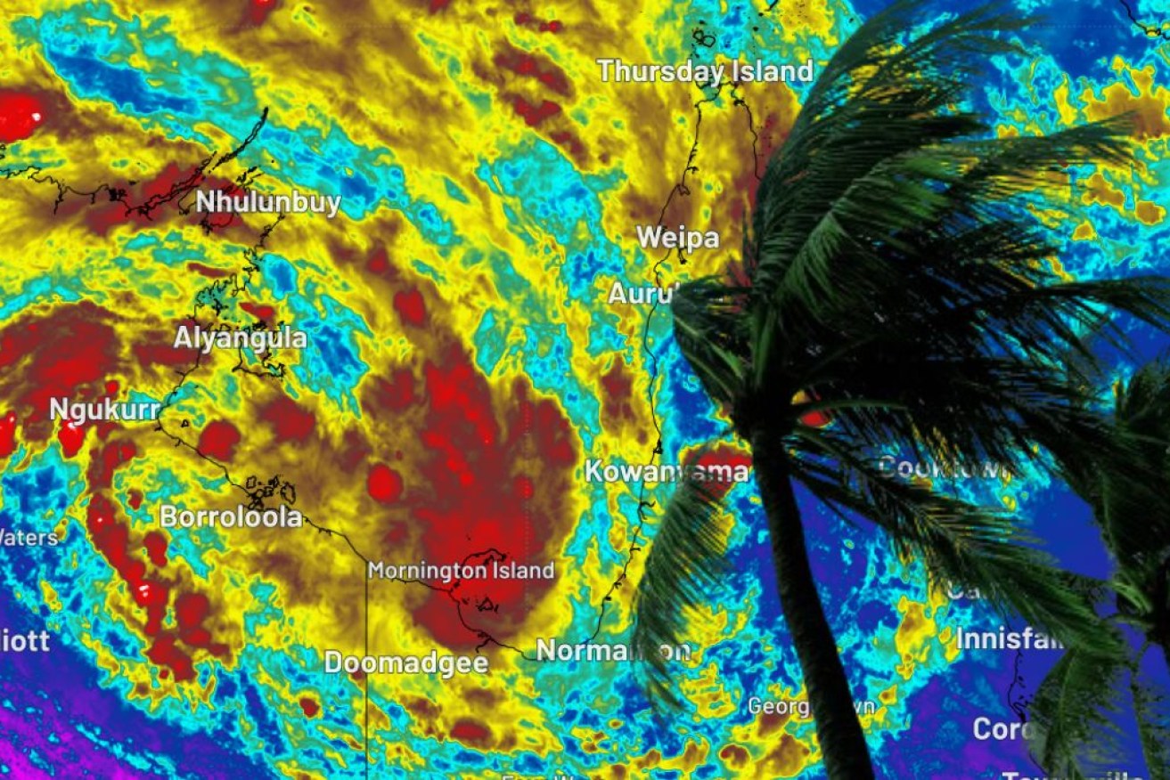
Tropical depression Lincoln has weakened below cyclone intensity but will continue to deliver strong winds and heavy rain to already soaked areas of the Top End as the system drifts towards Western Australia.
Expected to reach WA’s Kimberley region by Monday, Lincoln does however have the potential to redevelop as a tropical cyclone off the coast next week, perhaps by Thursday, forecasters say.
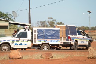
Coastal communities were placed on alert as Lincoln made landfall on the Gulf of Carpentaria’s southwest coast on Friday evening.
It was feared the then category one storm would batter already rain-lashed centres in the Northern Territory before moving inland and weakening in intensity.im
A severe weather warning was issued for heavy rain and damaging winds for the western Gulf Country including Queensland’s Burketown, with wind gusts up to 110km/h and downpours predicted.
Severe storms were also forecast for the Peninsula and North West.
Rain and more rain
Tennant Creek and Elliott in the NT, and some northern parts of Queensland were expected to record 24-hour rainfall totals of 50mm to 100mm, with 200mm possible in isolated areas.
The Bureau of Meteorology said early Saturday that ex-Tropical Cyclone Lincoln was laying over the eastern Carpentaria District and would move across the northern Barkly and northern Tanami, bringing heavy rain before entering WA early next week.
A ridge over central Australia will weaken over the weekend, causing humidity over southern districts to increase, and bringing the chance of showers and thunderstorms.
The bureau said the system was at “moderate” risk of becoming a cyclone again if it reached waters west of the Kimberley in WA later next week.
In Queensland’s northwest, communities remain isolated following widespread flooding in the wake of Tropical Cyclone Kirrily, which lingered for days after crossing the state’s coast weeks ago.
More than 60 residents have been evacuated from Burketown, which recorded 135mm of rain in 24 hours.
In the NT, people have been evacuated from the community of Beswick, south of Katherine.
The body of a woman was found in a submerged car in floodwaters near Mount Isa on Thursday. It is believed the 28-year-old had tried to drive through a flooded causeway.
Meanwhile, low-lying areas of Brisbane were under water on Friday after the city had its wettest day since the 2022 floods.
Rosalie recorded 197mm, Bowen Hills copped 135mm and 148mm soaked Mt Cootha.
-AAP