Cyclone set to form as coast braces for strong winds

Once Cyclone Kirrily crosses the coast, Queensland could be impacted by flooding for days. Photo: AAP
An anxious wait for Tropical Cyclone Kirrily is almost over, with damaging winds and heavy rain set to lash north Queensland.
Days after it was first expected to appear, Cyclone Kirrily is finally set to form off the Queensland coast on Wednesday night.
Police, energy and emergency crews from across Queensland and interstate have headed north in preparation for the arrival of what is now expected to be a category two system on Thursday night.
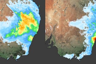
Winds of 120km/h are set to hit the Whitsunday Islands on Wednesday night, with Cyclone Kirrily currently set to cross the coast between Townsville and Ayr about 24 hours later.
But state disaster co-ordinator Deputy Commissioner Shane Chelepy urged people to monitor alerts, saying it remained to be seen where the “unreliable” system would end up.
“What we’ve seen over the last couple of days is this cyclone or this tropical low has been inconsistent,” he said.
“It has been a bit unreliable. We were expecting this tropical low to form into a cyclone two days ago.
“You know it is moving around a little bit and we won’t know for certainty the crossing points until it forms so …please stay in contact with our local messaging.”
The Bureau of Meteorology said Kirrily’s arrival had been delayed due to conditions not conducive to tropical cyclone development.
However, that was expected to change on Wednesday.
“Once these conditions improve, which look to happen today and into tonight, we are likely to see it develop into a tropical cyclone tonight,” a bureau spokesman said.
Once Kirrily forms it is expected to intensify before hitting the north Queensland coast, bringing damaging winds and widespread heavy rainfall that may lead to flash flooding.
“In those areas (of impact) we could see winds gusting to 120km/h with damaging to destructive winds that could bring damage to homes, properties and businesses,” the bureau spokesman said.
Communities in Kirrily’s sights have been told to bunker down.
“The next 24 hours is critical for our communities, all the way down from Cardwell down to the Whitsunday area, to prepare for this crossing,” Mr Chelepy said.
“As of this evening, we will ask the community to start limiting their travel in these areas due to strong winds and rain.”
People have also been asked to reconsider their Australia Day long weekend plans, with a number of campgrounds set to be closed on Wednesday.
Once Kirrily crosses the coast, it is expected to rapidly weaken as it heads inland.
However, the system may yet still cause more devastation as it moves further inland and south.
The low is set to bring widespread rain and flooding that may impact the state for days, with heavy showers expected to hit central and western Queensland from Friday.
But the bureau said the risk of southeast Queensland being impacted had lowered on current modelling.
It is some relief for a region that is still recovering from a devastating Christmas period in which seven people died in storm-related incidents.
Kirrily is the second cyclone in barely a month to threaten Queensland.
Cyclone Jasper caused record flooding that devastated the far north in mid-December.
Fatigued emergency crews are set to receive interstate and Australian Defence Force support after the massive recovery effort that followed Jasper and the southeast storms, with NSW back-up arriving on Wednesday.