NSW, Vic face flood threat, as freak summer storm slams Perth
NSW and Victoria face potentially life-threatening flash flooding, with intense rain expected on both sides of the border on Wednesday.
The heaviest falls are predicted for north-eastern Victoria and southern NSW along the Hume Highway, potentially putting people driving between Melbourne and Sydney at risk.
The Bureau of Meteorology has issued alerts for intense rain in an area spanning NSW’s southern tablelands, the ACT, Snowy Mountains, south-west slopes and the Riverina.
Also in the firing line area Victoria’s north-east, parts of east Gippsland and the west and south Gippsland forecast districts.
Six-hourly rainfall totals of 50-80 millimetres are likely, with 24-hourly totals of 80-120 millimetres possible in both states.
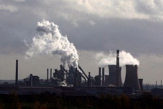
Meanwhile, a freak summer storm with hail and wild winds has smashed Perth’s Hills region during a sweltering heatwave, leaving thousands of people in the dark.
The intense system swept through on Tuesday afternoon (local time), with winds of 115km/h bringing down trees and buffeting homes and cars.
Western Power confirmed about 22,000 homes were left without power. Many homes may not be fully restored until later on Wednesday.
The storm slammed Perth in the middle of a three-day heatwave in which temperatures were hitting 41 degrees.

The Perth storm buffeted trees and brought down huge trunks. Photo: 9NEWS
Mundaring resident Peter Ketteridge told the ABC the storm smashed his suburb in minutes.
“It was 41 degrees, I was sitting outside, and within the space of about five minutes it dropped down to mid-20s and the hail started, rain was intense, a lot of water fell very quickly,” he said.
“A lot of rain, hail, thunder, lightning … half the marri tree came down on top of the roof. Luckily no one was inside at the time.
“I’d just been talking to the tree lopper about removing that particular tree … actually have to do it now because it’s unbalanced.”
Two cyclones
Meanwhile, Australia’s second cyclone of the season is brewing off the WA coast and is set to enter our waters, while a third cyclone is expected to develop in days in Queensland.
WA’s Cyclone Anggrek is expected to become a category two system on Wednesday after forming in the Indian Ocean, about 4000 kilometres off the coast.
Anggrek will enter Australian waters this week as it tracks south.
“It is highly unlikely to have any impact on mainland Australia but gale force winds could be felt in the Cocos Islands,” the weather bureau said.
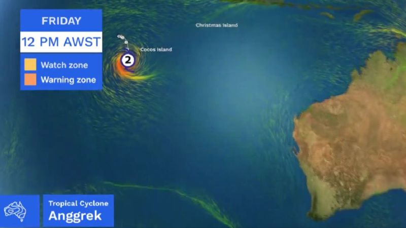
Where Cyclone Anggrek is expected to be on Friday. Photo: BOM
On the other side of the country, a tropical low that has developed off Cairns is expected to strengthen into a cyclone by Sunday.
While it is expected to remain offshore this week, the system is a chance of tracking back toward Queensland’s far north next week as a cyclone.
Wet weather may have delayed recovery work but some progress is being made at one of the worst hit areas north of Cairns, with temporary housing on the way for flood-hit Degarra.
Douglas Shire Mayor Michael Kerr said on Monday Degarra residents were at breaking point after caravans sent by the Queensland government were set up three hours away from displaced locals, describing it as “ludicrous”.
A day later, Kerr said “common sense has prevailed” with the state government assuring the council that caravans would be placed in Degarra.
“It’s better late than never, but I hope decision makers learn from this, and in the future mobilise help far more quickly and appropriately,” Kerr said.
“We are grateful to everyone working hard in this recovery effort and expect at least 30 more caravans to arrive by barge in coming weeks”.
-with AAP
Want to see more stories from The New Daily in your Google search results?
- Click here to set The New Daily as a preferred source.
- Tick the box next to "The New Daily". That's it.