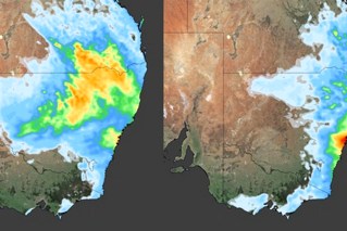
Summer danger warning despite record November rainfall
Source: BOM
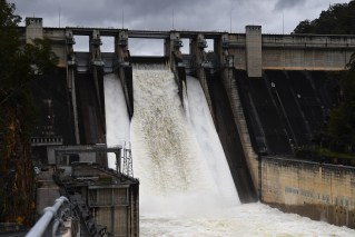
Towns are isolated and homes under water after parts of eastern Australia were slammed by record November rainfall, with more downpours on the way.
NSW’s far south coast bore the brunt of the wild conditions on Wednesday and overnight, with record rain in the coastal towns of Jervis Bay, Ulladulla, and Moruya which topped 200 millimetres in 24 hours.
Parts of Victoria could be next as the system moves over the border, with up to 200mm likely over East Gippsland.
But despite widespread heavy rain and floods, all states have been placed on heightened alert for a danger of another kind as summer looms.
The Seasonal Bushfire Outlook was released on Thursday which raised the alarm over the fiery months ahead – with large parts of the country at increased risk.
Significant rain over the past few years has led to more vegetation growth and difficult conditions to complete hazard reduction burns, according to the National Council for Fire and Emergency Services report.
The conditions will continue to dry out fuel loads, including some affected during the 2019/20 Black Summer season, increasing the risk of large bush and grassfires.
The current El Nino weather event of rising sea surface temperatures is tipped to peak in December or January.
The outlook points to above-normal fire potential in large areas of eastern, central and northern NSW with the drought expected to worsen.
Large parts of Queensland, NSW and the Northern Territory are most at risk while certain regions in Tasmania, Victoria, South Australia and Western Australia are also vulnerable.
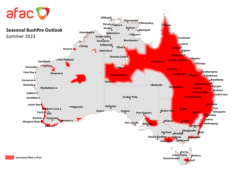
Large parts of Australia are at increased risk of fire. Map: AFAC
Queensland is “primed” for an extended fire season, particularly around the North Tropical Coast, while there’s also above-normal fire potential in central areas of the Northern Territory.
Southern parts of South Australia are at risk with higher fuel loads along transportation routes and Tasmania’s southeast has been put on alert.
Forest and shrubland areas in southern Western Australia face an above-average fire danger and the ACT faces a normal bushfire risk.
Authorities are also concerned about western and central Victoria, with Victorian Country Fire Authority chief officer Jason Heffernan warning suburbs in the Melbourne’s west could be under threat.
“I do expect to see fires encroaching in the Melbourne metropolitan region, particularly on the outskirts,” Mr Heffernan told reporters in Melbourne on Thursday.
Flood warnings
In the meantime, emergency service crews have asked residents to stay vigilant for the possibility of more heavy rain and flooding.
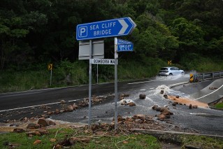
On Thursday, rapid impact assessment teams focused on homes in Lake Conjola, a small town on the NSW south coast.
The State Emergency Service estimated about 40 homes had been impacted by floodwaters across the region.
“Crews are still on the ground ready to respond to calls for assistance in the southeast, but the clean-up has started in some areas,” an SES spokeswoman said.
There are advice warnings for minor flooding at Sussex Inlet and the Bega River, thanks to ongoing rain combined with rising tides.
As of 5am on Thursday, crews had responded to 1056 incidents across the state, with more than 500 in the south-eastern zone.
Operations manager Dallas Burnes said almost 1200 personnel had been deployed to assist communities.
“There is still a severe weather warning in place for some of the south coast district with further rain and damaging winds today but we do expect it to gradually ease through the course of the day,” he told Seven’s Sunrise.
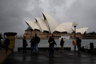
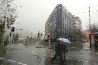
The Sydney basin was also drenched by Wednesday’s downpour, with intense rain soaking the inner-city, outer-west and southern suburbs from late afternoon.
The Bureau of Meteorology warned thunderstorms were possible in the south-east and central-east on Thursday afternoon and night, including in Sydney and Canberra.
The warning noted some thunderstorms in the south-east could become severe, with a risk of heavy falls causing flash flooding.
In far eastern Victoria, the town of Mallacoota was cut off after a landslide about 8.30am on Thursday. No one was hurt or cars damaged as it happened on a remote stretch of road.
Victoria SES chief operations officer Tim Wiebusch said debris was likely to be cleared by early afternoon. However, the town could again be isolated later in the day if the Genoa River experienced major flooding.
In the 24 hours to 7am on Thursday, the Victorian SES received 661 calls for help.
The Bureau of Meteorology forecast possible rainfall of 80-150 millimetres in the east, with up to 200 millimetres locally over parts of East Gippsland.
Three watch and act alerts were current for the region as of Thursday afternoon, with Mallacoota and areas surrounding the Cann River experiencing flash flooding.
-with AAP