Storms, heat, fire danger: States’ dangerous forecast
Heatwaves and extreme fire danger warnings have been issued for parts of Queensland and NSW, along with the threat of thunderstorms.
The weather bureau has issued heatwave warnings for parts of Queensland for much of the rest of the week, while the fire danger is expected to be extreme in parts of NSW on Thursday.
“Warm to hot west to north-westerly winds ahead of a drier, fresh and gusty south-westerly change extending from the west during the afternoon and early evening,” the Bureau of Meteorology wrote.
“Isolated thunderstorms and showers about the eastern ranges and coast during the afternoon and evening, possibly severe in the north. Thunderstorms possible over the northern and central inland also but little rainfall expected with risk of dry lightning.”
BOM said extreme fire danger was forecast for NSW’s northern slopes and north-western regions.
Thursday’s warnings came after two women were injured when a house was damaged during a storm at Winya, near Kilcoy, north of Brisbane on Wednesday afternoon that was reported to have ignited a bushfire.
The weather bureau said “fairly similar” storms were forecast for the southern half of Queensland on Thursday, with even worse expected on Friday.
Severe thunderstorms are predicted across the Wide Bay and Burnett regions as well as the south-east coast and parts of the Darling Downs late on Thursday. Heavy rain, large hail and damaging wind gusts are also expected.
The storms also bring the threat of fires being started by lightning, Queensland Fire and Emergency Services said.
There were more than 4000 lightning strikes in Kilcoy and surrounds on Wednesday in the hour from 2.40pm, the BOM said.
Severe thunderstorms with large hail are possible over much of the state’s south-east again on Thursday and there are strong wind warnings for waters on the Gold and Sunshine coasts.
Heightened bushfire conditions were also forecast to return to large parts of Queensland and Thursday, with maximum temperatures in the high 30s to low 40s in the central and southern regions.
Authorities fear heatwave conditions powered by strong winds and potential dry lightning strikes could reignite fire grounds.
More than a million hectares have burnt across Queensland since August 1, with 1000 fires reported since October 21.
About 50 fires are burning in Queensland.
Storms may also hit the Maranoa and Warrego regions as well as the central highlands on Thursday.
“It is looking like another active afternoon in the southeast,” the bureau spokesperson said.
The weather may get worse on Friday and affect a broader area, with storms set to move further inland and up to the north-west.
“It could well be worse tomorrow given that we do have a trough moving into a region where we already have got a whole lot of activity expected,” the bureau said.
The storms will combine with heatwave conditions. Temperatures of up to 10 degrees above average are forecast for some regions on Thursday.
Heatwave conditions are expected for parts of central west, Central Highlands, up into the north-west, Northern Goldfields, Upper Flinders and up to the Gulf of Carpentaria.
Temperatures will hover about 40 degrees in some regions with Longreach expected to hit 44, Winton 43 and Mount Isa 42 on Thursday.
Even overnight temperatures may be up to eight degrees above average in some regions, the bureau said.
There are severe heatwave warnings for Queensland’s Northern Goldfields and Upper Flinders, central highlands and coalfields, central-west, Channel Country, Wide Bay and Burnett and south-east coast districts until Friday.
Severe heatwave conditions are expected to ease over southern Queensland later in the week.
Forecaster Weatherzone said they were likely to be replaced by “substantial rain” from the weekend.
“The first half of November featured widespread rain and storms over part of every state and territory in Australia. This wet and stormy weather included ominous shelf clouds, plenty of outback thunder, and more than 8 million lightning strikes in a single week,” Weatherzone wrote on Wednesday.
It said Australia’s stormy November was likely to continue for at least another week, with upper-level troughs expected to trigger rain and thunderstorms over large parts of the country for up to 10 days.
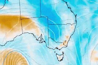
The bulk of the rain and storms will initially be in central Australia, northern and western South Australia and Western Australia until Friday. Wet weather is also likely to affect parts of NSW, Queensland, Victoria and Tasmania.
“It’s difficult to predict where and how much rain will fall over the next week due to the dynamic nature of the weather pattern, which will involve several upper-level and surface-based troughs,” Weatherzone said.
“At this stage, rain and storms are likely to affect part of every state and territory during the next seven days, with heavy falls possible over Queensland, NSW and central Australia. Some of the coming week’s thunderstorms are likely to become severe and heavy rain could cause flash flooding in some states.”
-with AAP
Want to see more stories from The New Daily in your Google search results?
- Click here to set The New Daily as a preferred source.
- Tick the box next to "The New Daily". That's it.