Australia faces new threat as La Niña fades and a major change looms in our weather

Source: Bureau of Meteorology
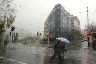
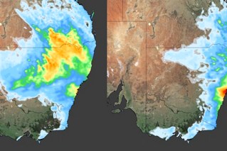
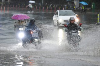
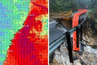
Australia faces an emerging weather threat, even as the La Niña that has brought record rainfall and devastating floods across the nation appears to be fading.
Much of Australia has been walloped by three years of La Niña weather conditions, and experts consider it highly unlikely we will see another in 2023, which means two options – either neutral conditions or an El Niño, bringing drier and warmer conditions.
In its most recent Climate Driver Update, released this week, the Bureau of Meteorology said the 2022 La Niña, which had led to increased rainfall, was slowly weakening.
With temperatures in the Pacific Ocean continuing to warm, there is a chance Australia – particularly the flood-battered regions in the south-eastern states – will soon face El Niño conditions. That is likely to mean drier and warmer weather.
“A neutral Pacific Ocean is what we are likely to see in the immediate aftermath of the current La Niña,” forecaster Weatherzone said.
El Niño‘s return?
“Indeed, there is good model consensus that the Pacific Ocean should return to a neutral phase by the end of the southern hemisphere’s summer (northern hemisphere’s winter).
“Then, as we venture further into 2023, it becomes unclear whether the Pacific Ocean will stay in a neutral state or transitions into El Niño.”
The prospect of an El Niño has many worried about the reduced rainfall and warmer temperatures. It could potentially mean another drought and, combined with excess growth spurred by all that recent rain, a dangerous fire threat.
“The seasonal bushfire outlook for summer identified potential for increased grassfire conditions for the 2022/23 fire season, due to significant grass growth and delayed harvest activities,” Victoria’s Country Fire Authority said in a recent bushfire update.
Concern is also echoed north of the Murray. NSW Rural Fire Service Commissioner Rob Rogers said western NSW, parts of Queensland and northern Victoria all had a large amount of fuel built up after months of heavy rain.
“There’s a massive amount of grass across those three states, and that’s what we’ve got to deal with the remainder of this summer and obviously looking forward to then the following summer,” Mr Rogers said on Friday.
He urged farmers to be extra vigilant during harvest, with heavy machinery able to spark the fires.
The Rural Fire Service issued a “harvest safety alert” to farmers in southern NSW this week as the danger increased.
Plenty of fuel getting ready to burn
“What really concerns us … is that we’re going to get in the second half of January really hot days and strong westerly winds,” Mr Rogers said.
“If we get fire starting like that with the level of growth out there and that growth is drying out, then those fires on those days will have the potential to be really destructive.”
There have been 920 grassfires in NSW since December 1, including 150 in the first five days of January.
While Mr Rogers said the bulk of the fires had been started by lightning, he reminded farmers using harvesters or other heavy machinery of the risks.
Over a 12-month period during 2021 to 2022 firefighters were called to 38 fires in NSW involving heavy equipment, 15 of those involved farming machinery such as tractors, harvesters and pickers.
Mr Rogers also warned that fuel was building up faster than usual across the five million hectares burnt in NSW in the deadly 2019-2020 fires.
“I don’t know whether it’s the amount of rainfall that super-soaked the soil, and then combined with the ash fertilising the soil … but whatever the combination is that vegetation has grown back a lot faster,” he said.
Mr Rogers said normally he wouldn’t expect the areas to burn again for up to eight years. But he expected with the accelerated fuel build-up it was likely to be as soon as 2024.
“The concern is anecdotally that that vegetation is really growing at a considerably faster rate than it normally would.”
Tweet from @weatherzone
Fire danger period for Victoria
Victoria’s CFA has warned of a fire danger period for four eastern council areas – Wellington, Baw Baw and South Gippsland shires and the City of LaTrobe.
It begins from January 16.
“The return of a La Niña weather pattern has led to widespread rainfall and flooding in parts of the state. However, that doesn’t mean communities can become complacent about the increasing fire risk this season,” CFA said in a release.
Victoria’s Emergency Management Commissioner Andrew Crisp has previously urged common sense in times of heightened fire danger.
The CFA warns that grass fires can produce huge amounts of radiant heat, which can kill anyone who is left exposed.
It advises people to seek shelter in a building that is well protected and actively defended. Shelter is also available at private and community fire shelters and Neighbourhood Safer Places.

