Tragic find in NSW floods – as Sydney smashes unwanted record

The body of a woman has been found in flood waters in New South Wales’ central-west, as the weather crisis affecting millions of Australians across five states takes a fatal turn.
NSW Police said although the body was yet to be formally identified, it is believed to be that of a 28-year-old woman who had not been seen since escaping a vehicle that was swept off a causeway at Gulgong, north of Mudgee, late on Sunday.
A 45-year-old male driver and two male passengers – aged 43 and 26 – got safely out of the vehicle.
There were also concerns in the Riverina region on Monday for a 71-year-old man who has not been seen since leaving his home on Sunday afternoon.
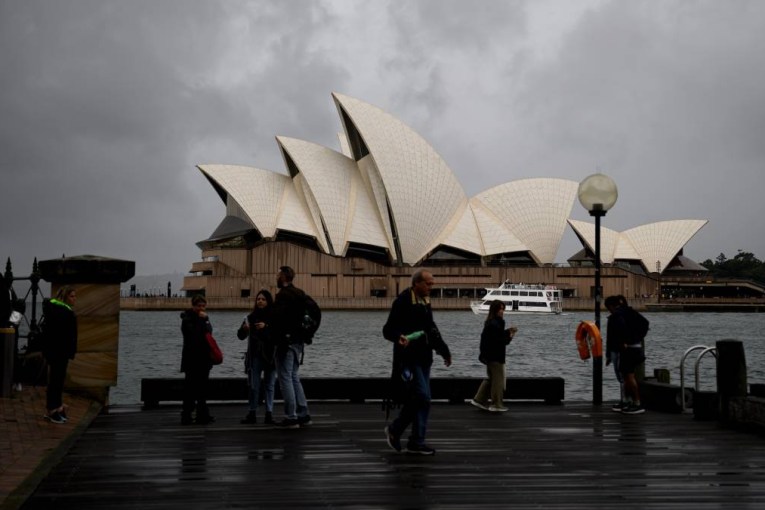
The tragedy came as Sydney smashed more records as heavy rain further soaked NSW and much of south-eastern Australia on Monday.
On Monday it was revealed the harbour city had officially endured its wettest October in 165 years of records, with a week of the month to run.
By lunchtime, 286.8 millimetres of rain had fallen in Sydney for the month – with more wet weather forecast for coming days.
October is the third month to set a rainfall record in Sydney this year. Weatherzone reports the city’s annual rainfall has reached 2387.6 millimetres.
“This is easily its wettest year in records dating back to 1859, beating 2194 millimetres from 1950,” Weatherzone said.
“Remarkably, Monday morning’s rain has also put Sydney into the top five annual rainfall totals on record for any Australian capital city. The only capital that beats Sydney’s 2022 annual total is Darwin, which has seen up to 2776.6 millimetres in one year.”
Tweet from @Ben_Domensino
More than 140 flood warnings and 15 evacuation warnings remain active across NSW, with almost every corner of the state at risk.
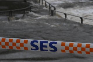
There are 550 State Emergency Services volunteers in the field, with reinforcements from Western Australia due to arrive on Monday.
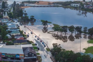
Some low-lying parts of south Lismore were already under water on Monday as the town faced the prospect of its third major flood in eight months. However, this round of flooding in the NSW northern rivers is not expected to be as severe that endured in the region earlier this year.
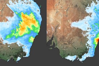
The Bureau of Meteorology said severe thunderstorms were likely later on Monday across much of southern Queensland, inland NSW and, possibly, northern Victoria – bringing heavy rain, damaging winds and large hail.
“Showers and thunderstorms will contract into eastern Queensland and NSW on Tuesday with showers continuing across Victoria and Tasmania. Severe thunderstorms are likely again on Tuesday in north-east NSW and South-East Queensland,” it said.
Emergency Services Minister Stephanie Cooke said authorities were keeping a “very, very close eye” on Lismore and the wider region.
“We all know how much those communities have been through this year,” she told ABC TV.
There are also concerns about Moree in the far north, where the town is experiencing its worst flooding in a decade.
Farmers in the agricultural hub were just weeks away from harvesting crops, which are now destroyed.
“It’s heartbreaking. There’s no doubt the damage and devastation through that region will be deep and widespread,” Ms Cooke said.
The Mehi River at Moree peaked at 10.5 metres on Sunday and is expected to remain above the major flood level (8.8 metres) into Tuesday.
Mayor Mark Johnson said there was a sense of relief on Sunday night when the river started to recede but also apprehension about the clean-up.
Other towns at risk of flooding include Hay, Wentworth, Ballina, Yamba and Maclean.
There are evacuation orders for Moree, Terry Hie Hie, Gunnedah and Carroll in the state’s north, the Riverina town of Narrandera and Mudgee in the central west.
Meanwhile, a second system is bringing more rain to already saturated parts of the state.
Residents have been ordered to higher ground at Cummeragunja and Mathoura East on the Murray River, where flood waters are expected to peak on Monday.
Authorities continue to keep a close eye on the southern border town of Moama, with major flooding expected on Monday when the Murray River peaks at 94.9 metres – higher than the 1993 flood.
Source: Victorian SES
Flash flooding threat for Victoria
There are fears of flash flooding across Victoria’s north as more rain and thunderstorms hit, just as the Murray River peaks at Echuca.
Many towns are on track to experience their wettest October on record, with 30 to 60 millimetres of rain predicted in the next 24 hours.
There is major flooding in Echuca with the peak expected later on Monday, where dozens of houses built along the banks of the Murray have been swallowed up by water.
About 30 millimetres of rain fell overnight and flood walls have so far protected the centre of town from the worst of the disaster.
But properties on the so-called wrong side of a levee constructed over the past week to save major infrastructure have started to flood.
The Murray River surpassed the 1993 flood level at Echuca on Saturday while the Loddon River at Kerang peaked but the threat is yet to pass.
Flood waters there have only slightly receded and are not expected to noticeably drop for several days.
SES chief operations officer Tim Wiebusch said the emergency was still unfolding.
“Victoria is still in a flood emergency and we’re seeing all phases of the emergency uncovering itself here in Victoria, whether that’s preparation, response and through to recovery,” he said.
Recovery efforts across central Victoria are about to ramp up, particularly in Rochester and Mooroopna, which were badly damaged by flooding almost a fortnight ago.
So far about 4000 CFA volunteers have assisted communities prepare or clean up.
Residents from Swan Hill to Mildura have been told to be on alert and prepare for flooding from the end of the month.
There is also flood danger in South Australia, where heavy rain across the mid-north and in the Riverland has caused localised flooding, closing roads and prompting dozens of calls for help.
A watch and act warning remains in place for Stockport, about 75 kilometres north of Adelaide. The rising Light and Gilbert rivers pose a threat to local homes.
The State Emergency Service said people in the area should prepare for flooding and if they planned to leave, should do so.
Concerns are also growing for Murray River communities expected to be affected by rising water levels during the next few weeks.
Flows down the Murray are expected to rise to 120 gigalitres a day by early December as water from the NSW and Victorian floods makes its way down the river system.
Those high flows are expected to inundate some riverside homes, shacks, businesses and community infrastructure.
In Queensland, major flooding is expected along several rivers, while Tasmania also have five active flood messages. See all the latest BOM warnings here.
-with AAP
