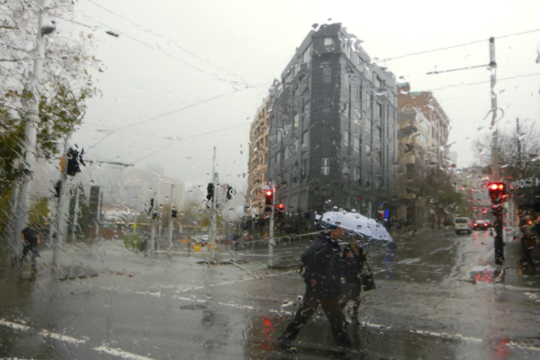
Flash floods, hail, rain: Nightmare for Friday commuters
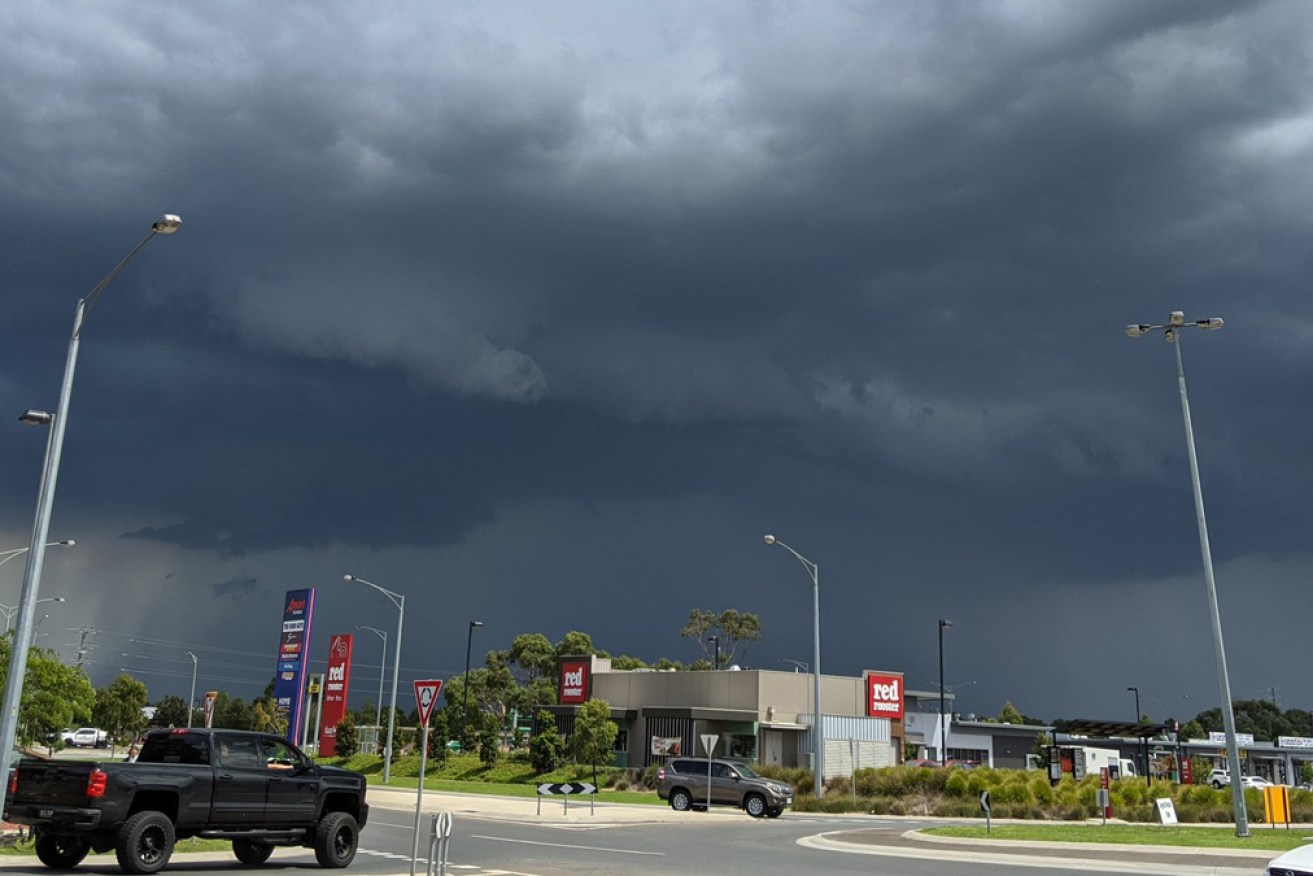
The storm rolls towards Pakenham, in Melbourne's outer south-east. Photo: Twitter
Thunderstorms dumped heavy rain across Melbourne on Friday afternoon, with forecasters warning hail and flash flooding could follow just as commuters headed home for the weekend.
The Bureau of Meteorology warned severe thunderstorms would bring dangerous weather across swathes of the city for several hours from 2pm on Friday.
“These thunderstorms … are forecast to affect [suburban] Laverton, Scoresby and Werribee by 3.10pm and Melton, St Kilda and Williamstown by 3.40pm,” the bureau said.
“Heavy rainfall may lead to flash flooding and large hailstones are likely.”
Bureau senior forecaster Michael Efron said heavy rain, isolated flash flooding and hail were all possible in Melbourne as the storms moved “very slowly” across the state.
The thunder is so thick over my part of Melbourne right now it sounds like I'm in a recreation of the Blitz. #melbweather
— NewsCorp Rims Fascists (@TheGrimRecapper) February 14, 2020
Incoming…#Pakenham #vicweather #melbweather pic.twitter.com/HgucEto7XR
— theloneisobar (@DeanSgarbossa) February 14, 2020
The weather bureau said Sheoaks, 100 kilometres west of Melbourne, had already recorded 54 millimetres of rain in 50 minutes on Friday.
The storms also brought wind gusts of up to 100km/h to Horsham in the Western District.
There were also reports of flooded roads and shopping centres, most in Melbourne’s east and south-east.
Mr Efron said the storms would be “quite hit and miss” – some areas might miss out altogether, even if there was significant flash flooding elsewhere.
https://twitter.com/busty_bella/status/1228179053527461889
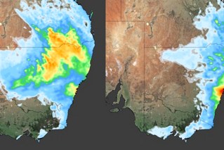
The threat to Melbourne was accompanied by a more general severe thunderstorm warning for other parts of Victoria, including the Mallee, west and South Gippsland, Wimmera, and areas in the state’s south-west, north central and parts of East Gippsland, the northern country and north-east districts.
There was also a warning for NSW residents, with slow-moving storms expected to bring heavy rain and hail to inland and southern areas.
#Storms have developed in parts of southern New South Wales. Slow moving storms may generate heavy rainfall. Across the southern inland hail is also a risk. Check the latest warning at https://t.co/GrhEIEmePL pic.twitter.com/kXjpfXS99q
— Bureau of Meteorology, New South Wales (@BOM_NSW) February 14, 2020
Friday’s weather warnings came as ex-tropical cyclone Uesi was due to pass close to Sydney later on Friday and early Saturday, bringing dangerous surf conditions.
A hazardous surf warning is in place for much of the NSW coast on Friday and for the Hunter, Sydney, Illawarra, Batemans Bay and Eden on Saturday.
Other parts NSW can expect more wet weather at the weekend, following last week’s deluge, particularly the bushfire-ravaged South Coast, the Southern Tablelands and western Sydney.
Thousands of residents in Sydney and the Central Coasts are still without power.
Ausgrid said 13,000 customers were still without power on Friday and aimed to have services fully restored by Sunday night.
The rain has brought much-needed relief for firefighters, with the NSW Rural Fire Service on Thursday confirming there were no uncontained fires for the first time this season.
It has also given a boost to Sydney’s parched dams. Warragamba Dam was at more than 76 per cent capacity on Friday, up from 43 per cent a week ago.
-with AAP