Millions set to shiver as storm brings sleet, snow and gale-force winds
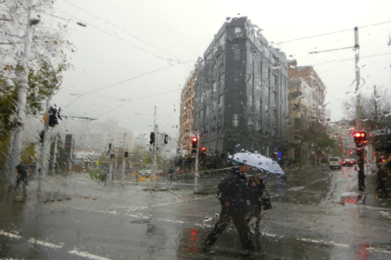
A series of cold fronts is likely to bring freezing weather, snow and lots of rain to parts of Australia on Thursday and Friday. Photo: Twitter/BOM
Brace yourself, winter is far from over. Nor will it give up its grip easily, with the season’s “strongest weather system” closing in for millions of Australians.
The weather bureau has urged Victorians to prepare for the worst of a massive winter storm rolling in from Bass Strait on Thursday and Friday.
But northerly regions won’t escape, with the bureau unable to rule out a flurry of snow on the NSW-Queensland border.
The grim forecast for the end of the working week also promises damaging winds, rain – and bitter cold.
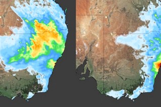
South Australians will be the first to feel the full force of the storm, with westerly winds strengthening from late on Wednesday before reaching gale force on Thursday. There will also be decent rainfall for the Mount Lofty ranges.
North of the Murray, NSW residents have been warned to brace for a similar chill, showers and westerly winds. The Bureau of Meteorology has issued wind warnings for much of the NSW south coast.
SEVERE WEATHER UPDATE: strongest weather system this winter for SE Australia, with possible sleet/snow on #NSW #Qld border. Video current at 12 pm AEST, 7 August 2019. Check warnings at https://t.co/0iBm75CO79 & follow advice from emergency services pic.twitter.com/0rzydto2yC
— Bureau of Meteorology, Australia (@BOM_au) August 7, 2019
Commercial broadcaster Weatherzone said a series of cold fronts driven by the deep low pressure system would bring rain, hail, thunderstorms, snow, damaging winds and blizzards to south-eastern Australia in the next two days.
“The impending low pressure system and associated cold fronts are likely to affect parts of South Australia, Tasmania, Victoria, NSW, the ACT and southern Queensland,” it said.
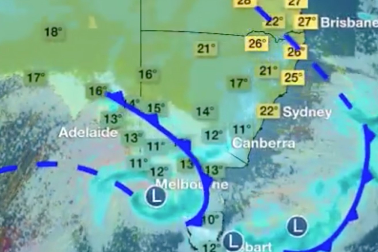
On Friday and Saturday, temperatures in parts of Melbourne are forecast to peak at just 10 degrees. Alpine regions in Victoria and NSW will dip below freezing and blizzard conditions are expected.
“It’s certainly going to get quite cold, something to brace for. Maximum temperatures on Friday and Saturday, in particular, will be the coldest couple of days,” the Bureau of Meteorology’s Steven McGibbony said of the outlook for Victoria.
Elsewhere, Canberra’s peaks might get some snow, along with the regional centre of Armidale.
“The cold air will extend up through NSW right across the weekend, with fairly widespread damaging winds, including Sydney, Wollongong and populated parts of the east coast,” spokesman Michael Logan said.
A series of cold fronts are forecast to cross SA on Wednesday and move through Vic, Tas and NSW by Saturday. We expect to see very windy conditions, rain, hail and snow in low lying areas (highlighted at 0:17 in this video) ❄️ Alpine areas could expect damaging winds pic.twitter.com/rWxhw3wHnA
— Bureau of Meteorology, Australia (@BOM_au) August 6, 2019
Gusts of up to 110 km/h are expected from late Thursday, with Victoria’s Alpine region in for dangerous blizzard conditions with wind speeds reaching 120km/h.
Snow could fall as low as 500 metres above sea level in the region by Friday morning. The Victorian Alps and the Thredbo and Perisher resorts in NSW have been warned to expect up to a metre of snow in the next two days.
“It looks as though there will be at least half a metre of snow at the main resorts by the end of the week,” forecaster Richard Carlyon said, adding it will likely lead to blizzard conditions.
There are also gale warnings for Tasmania’s southern coastlines for Wednesday, and strong wind warnings for the state’s north and east for Thursday.
Temperatures are not expected to rise again until the middle of next week.
-with AAP