State of emergency declared as northern Australia braces for twin cyclone threat

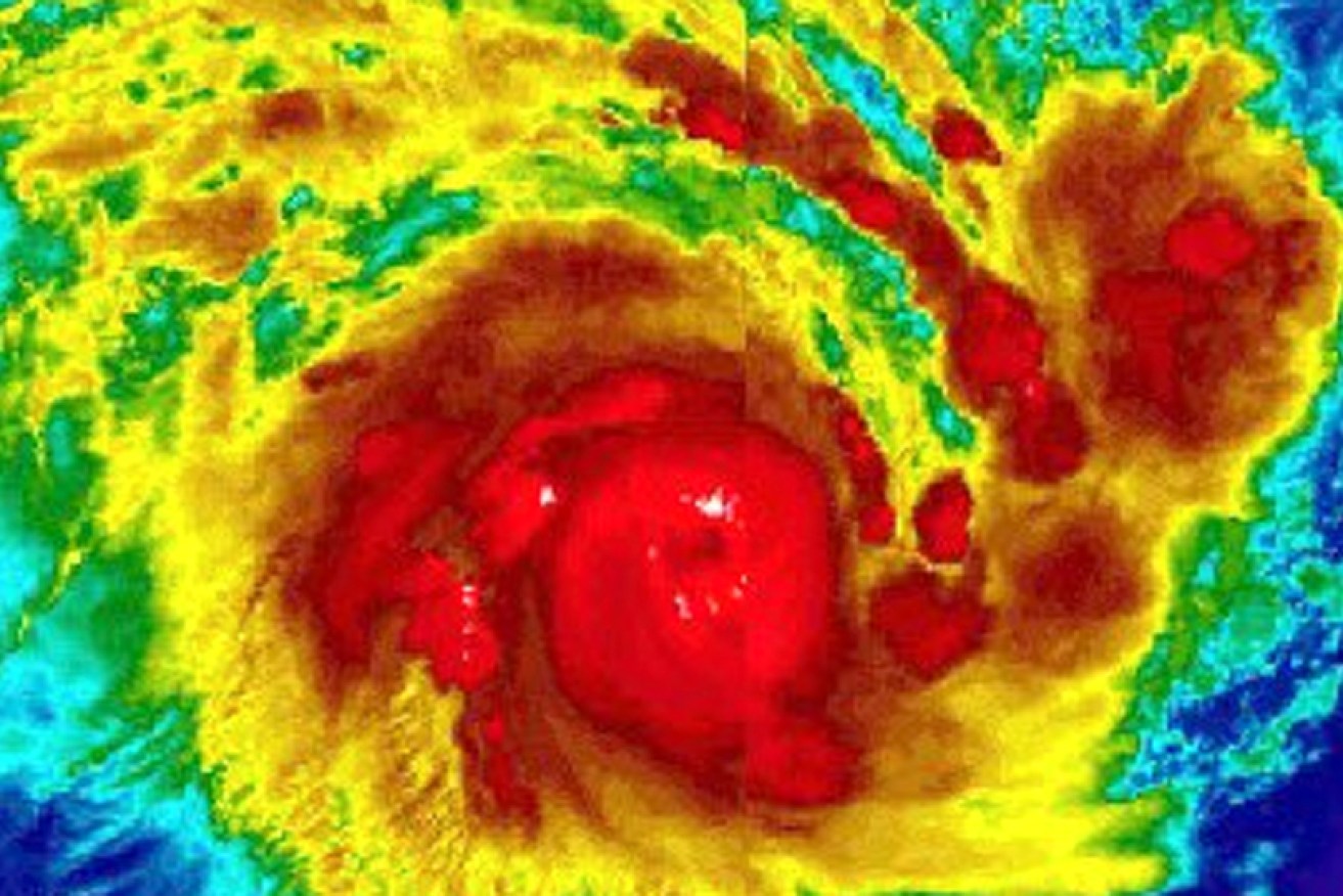
The eye of Cyclone Veronica as it intensifies off WA. Photo: Twitter/Nicholas Barretto
Mass evacuations are under way in the Northern Territory, and a state of emergency has been declared in the Gulf of Carpentaria, as the region braces for the potentially devastating effects of two cyclones.
Cyclone Trevor, which hit far north Queensland earlier this week, was expected to rapidly re-intensify into a category three as it slowly crossed the gulf westwards.
The weather bureau said Trevor might emerge as a dangerous category four cyclone when it crosses the NT coast on Saturday.
“The Bureau of Meteorology is forecasting that the cyclone will make landfall between Borroloola and Groote Eylandt during Saturday as a category four severe tropical cyclone,” Northern Territory Chief Minister Michael Gunner said.
“Marine conditions in the gulf are deteriorating from this morning.”
The bureau has also issued a warning about Cyclone Veronica, a category four system off the northern Western Australian coast.

Cyclone Trevor’s predicted path from Queensland to the Northern Territory. Photo: BOM
Cyclone Trevor would bring “very destructive winds, with gusts to 260km/h, heavy rainfall and a very dangerous storm tide are expected near the cyclone centre as it approaches and crosses the coast”, it said.
Before that, the community of Groote Eylandt – about 2800 people – was being evacuated by air on Thursday.
The smaller community of Numbulwar, with more than 500 residents, was being evacuated by road as it would likely be cut off otherwise.
2000 people will be evacuated from remote NT communities. This is the largest evacuation since Cyclone Tracy. #CycloneTrevor https://t.co/jt23dathAU
— abcemergency (@ABCemergency) March 21, 2019
Most people will be taken to Darwin by the RAAF, in the largest evacuation of people across the NT since Cyclone Tracy in 1974.
“Our information tells us that this severe cyclone will be extremely dangerous and too dangerous for people to shelter,” NT Emergency Services regional controller Travis Wurst said.
“The system will be large and intense, with significant damage expected.
“Some people have already self-evacuated.
“Everyone else in these communities is asked to be ready for evacuation across today and tomorrow.”
In Queensland earlier this week, Trevor uprooted trees, caused flooding and roof damage, closed schools and roads and downed power lines with severe wind gusts and heavy rain since it made landfall earlier this week.
Overnight on Wednesday, Trevor lashed the Aurukun community. Some 180 places were without power on Thursday morning as residents began cleaning up.
Ergon Energy said it would fly in crews from Mareeba and Cairns – weather permitting – to begin the restoration effort.
The timing of Cyclone Trevor is uncertain, with gales still expected across western parts of Cape York Peninsula on Thursday.
The Bureau of Meteorology predicts Trevor will make landfall between Borroloola and Groote Eylandt as a category four severe tropical cyclone, with marine conditions in the Gulf of Carpentaria deteriorating from Thursday.
It could lead to heavier rain bands affecting other parts of the NT, including Darwin, with potentially severe thunderstorms, damaging winds and flash flooding.

Cyclone Veronica’s predicted path towards the WA coast. Photo: BOM
Cyclone Veronica, meanwhile, is expected to track towards the Pilbara on Thursday and Friday. Residents have been warned to prepare for dangerous high tides and storm inundations.
“Destructive winds with gusts to 130km/h are forecast to develop along the Pilbara coast during the weekend, with a period … with gusts in excess of 165km/h possible as the cyclone approaches the coast,” the bureau said.
“Widespread very heavy rainfall conducive to major flooding is likely along parts of the Pilbara coast over the weekend.”
Cyclone Veronica is showing perfect organized structure, with a pinhole eye starting to take shape. This is explosively deepening too a very intense storm, people in west Australia should also take this storm very seriously as it gets closer. pic.twitter.com/yZlHJKtsyl
— Nicholas Barretto (@StormBarretto) March 20, 2019
-with AAP
