Severe winds for south east Aus

AAP
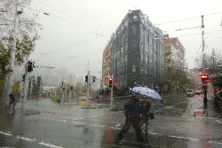
Thunderstorms are developing in Victoria and southern NSW with a cold front that has brought with it high winds and some rain.
Severe weather warnings for damaging or destructive winds remain in place from the Nullarbor Plain to the Snowy Mountains as two cold fronts cause winds with gusts well exceeding 100km/h in many elevated areas.
Thunderstorms are developing in Victoria, NSW and South Australia as the fronts pass.
A severe weather warning is in place in Victoria for the north east, West and South Gippsland and East Gippsland but has been lifted in central and western regions.
Thunderstorms are expected across central and eastern parts of Victoria and will enter southeastern NSW late Tuesday night as the cold front passes, Bureau of Meteorology senior forecaster Phil King told AAP.
“The storms are developing in a line from Echuca and Swan Hill to Melbourne at the moment and there is a risk that they will develop and possibly become severe from mid-afternoon,” he said.
Damaging winds of 60km/h winds gusting up to 100km/h are expected in elevated areas, with peak gusts up to 150km/h in alpine areas.
Gusts reached 139km/h at Mount Hotham, 115km/h in the Grampians and 105km/h at Fawkner Beacon in Port Phillip Bay.
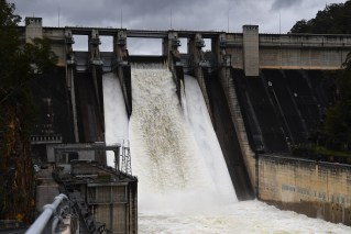
A flood watch is in place for the Melbourne area, northeast Victoria and the Goulburn and Broken river catchment.
Similar windy conditions persist in the NSW Snowy Mountains and the ACT.
A gust of 153km/h was recorded at Thredbo on Tuesday morning.
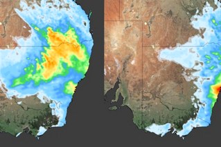
Severe winds endure in South Australia as a second cold front approaches.
A severe weather warning for damaging winds remains for all coastal weather districts and parts of the Flinders and Murraylands districts.
Gusts up to 90km/h are expected near and for several hours after the front, particularly with showers or thunderstorms.
Mr King said that front would cross Bass Strait on Tuesday night, with another front on Thursday to bring cooler weather.
In Tasmania, a flood watch has been issued for northern river basins, where up to 45mm of rain has fallen and another 15mm is possible on Tuesday.
Since midnight, there have been gusts of 117km/h at Mount Read and Mount Wellington, 102km/h at Low Rocky Point and 100km/h in the Hartz Mountains.