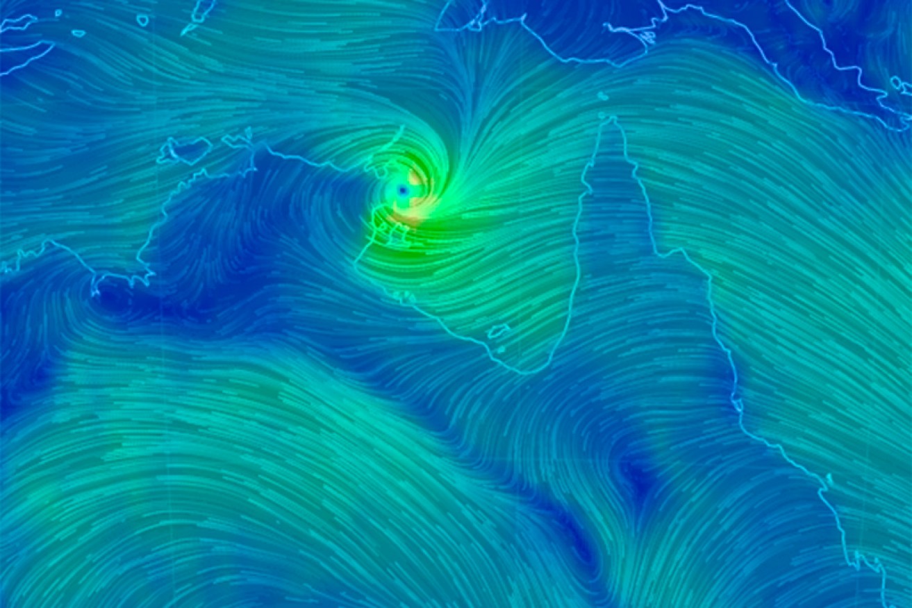
Nathan lashes Arnhem Land coast

Cyclone Nathan has passed over the mining town of Nhulunbuy on Northern Territory’s far east coast and is heading straight for Elcho Island, which is still in recovery mode from last month’s Cyclone Lam.
Winds above gale force strength are being felt on Elcho Island, as storms along the leading edge of Cyclone Nathan sweep in a clockwise direction as the system tracks north-west at around 14 kilometres an hour.

Cyclone Nathan reaching the NT coast.
At Gapuwiyak, about 110 kilometres south-west of Nhulunbuy, people were crowding together to seek refuge in houses as there were no approved cyclone shelters in the tiny community.
• If a cyclone comes, we won’t have a chance
• Australians feared among the missing
• Vanuatu food shortage fears
• In Pictures: the monster known as Cyclone Pam
• Cyclone Pam smashed us like a pounding surf
“Most of the people that are moving in are family with a couple of kids,” incident controller Raymond Musgrave said.
“So, 20 people in a three-bedroom house is not too much to ask for a day.”
At the main community of Galiwinku on Elcho Island, residents living in homes already damaged by category four Cyclone Lam in February had been warned to brace themselves for Cyclone Nathan, despite it being rated as less powerful.
“This is another tropical cyclone and we have to treat it as any other cyclone,” Northern Territory Emergency Services (NTES) director Andy Wharton said.
Elcho residents who were being accommodated in tents on the community’s football oval have taken shelter where they can, with the tents being pulled down as Nathan’s loomed off the coast.
Police and community members have used the town’s public address system to warn people of Nathan’s approach.
Communities in the cyclone’s path further along the coast of Arnhem Land are on high alert for Nathan’s destructive winds and heavy rains which are expected to bring storm surges, flooding and river rises.
“A degree of uncertainty remains in the likely track of Nathan in the longer term, but at this stage we expect that Nathan could track over the north-west Top End coast as a tropical low towards the middle of this week,” the Bureau of Meteorology (BoM) said in a statement.
It warned rainfall could be up to 300mm and result in closed roads.
“These falls are expected to lead to significant stream rises which may affect road access at times. Some communities may become isolated.”
Danger not over yet, Nhulunbuy residents told

Clouds gather near Nhulunbuy. Photo: ABC
Residents of Nhulunbuy, near where the cyclone crossed the coast, have been told by authorities to remain in their shelters as the danger has not passed.
The destructive core of the category two storm made landfall around 8:00am (CST) between Nhulunbuy and Cape Shield, about 650 kilometres east of Darwin.
The weather bureau said destructive winds with gusts up to 150 kilometres per hour, extending out to around 40 kilometres from the centre of the cyclone, were experienced over the Gove Peninsula area.
The cyclone is expected to continue crossing north-east Arnhem today and begin to weaken as it moves westward parallel to the Top End north coast during Monday.
Rio Tinto sent employees at the Gove refinery a message that only skeleton crews were to work at essential operations.
Nathan moved into the Gulf of Carpentaria on Saturday morning as a category one system with gusts up to 90 kilometres per hour, defying predictions it would weaken back to tropical low strength as it passed over the land mass of Cape York.


