Heatwave persists, cool change not until later in week
Source: Bureau of Meteorology
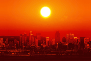
Heatwave conditions are set to persist for large swathes of the country with a cool change not expected until later in the week.
A wave of hot weather had some regions swelter through temperatures that peaked in their mid-40s on Tuesday.
But the wave is not over yet with the weather bureau forecasting both maximum and minimum temperatures to be 5-12 degrees above average throughout the rest of the week.
For NSW, temperatures are set to reach the mid-30s to low-40s during the day and low to high 20s overnight with the mercury at its highest on Thursday and Friday.
Severe heatwave conditions will develop across the central and northern inland parts of the state, spreading east towards Sydney, the Hunter and mid-north coast on Wednesday and Thursday.
Armidale, Camden, Campbelltown, Hornsby, Liverpool, Moree, Nowra, Orange, Richmond and Wollongong are all set to bear the brunt of the heat.
Some regions in the north-west slopes and plains such as Walgett are expected to reach 42 degrees while parts of upper western NSW including Wilcannia could peak at 46 degrees.
NSW State Emergency Operations Controller, Deputy Commissioner for Emergency Management Peter Thurtell urged people to watch out for heat stroke or heat exhaustion.
Severe heatwave conditions are also forecast for South Australia’s north-west, north-east and Flinders regions with some areas expected to hit the mid-40s.
It will be another scorching day for the southern state after its capital nudged more than 41 degrees on Tuesday afternoon, the first plus-40 day of the year.
Extreme fire dangers are also forecast for parts of the Pilbara coast on Wednesday.
A cool change was expected later on Wednesday with a low-intensity heatwave lingering across the north-east by Sunday, the Bureau of Meteorology said.
– AAP
