Residents door-knocked as floods cut off town – with more rain to come
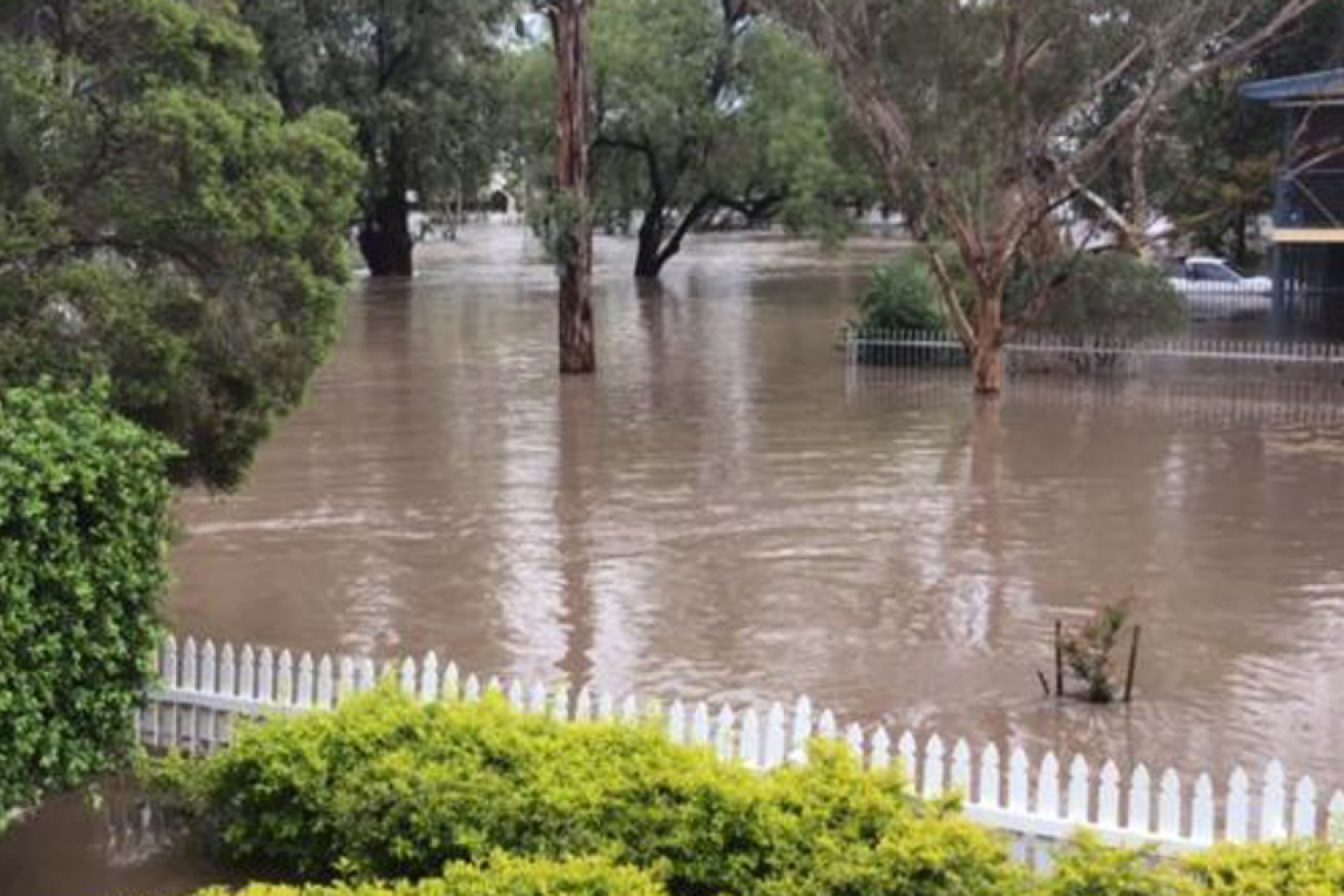
Flooding in Jandowae, in Queensland's Western Downs, on Tuesday. More rain was forecast for Wednesday. Photo: Twitter
Authorities are door-knocking residents of a town in Queensland’s Western Downs as severe storms threaten to dump up to 250 millimetres of rain on the already sodden area.
An emergency flood warning was earlier issued for Jandowae, west of Brisbane, but cancelled on Wednesday afternoon.
But the Western Downs Mayor Paul McVeigh said emergency crews were door-knocking residents ahead of predictions of up to 250 millimetres more rain in an area that already had more than 100 millimetres on Tuesday night.
“We do expect these waters to rise very quickly and [we’re] letting everyone know to take precautions,” he said.
UPDATE: Emergency Alert for Jandowae has been CANCELLED https://t.co/au7QLqLP7V
— Qld Fire & Emergency (@QldFES) February 12, 2020
The rising floodwaters have already formed an inland sea that has isolated Jandowae, which has a population of about 250, and at least two homes have been affected.
Bus services have been cancelled and roads surrounding the town are closed. It is cut off from the nearby centres of Dalby and Chinchilla.
“We are on the creek and can report biggest flooding I can remember,” resident Lee Labrie posted to social media.
“Had to move our horses as paddocks totally flooded. We had good steady rain all night but obviously much more in the headwaters of Jandowae Creek.”
Emergency flood alert issued to Jandowae residents on Queensland’s Western Downs https://t.co/YkBJcyLZwk pic.twitter.com/Y9x44eWU0q
— idiothead (@brisbanesnews) February 12, 2020
The creek was expected to peak on Wednesday, potentially leading to major flooding in the town, the Western Downs Regional Council said.
Chief executive Ross Musgrove said several properties had already reported minor damage.
“It does look as though the floodwaters in the Jandowae Creek have peaked, but there could be a second peak,” he said.
Elsewhere in Queensland, a severe storm warning was also issued on Wednesday for an area from Brisbane’s bayside to the Gold Coast, with up to 250 millimetres of rain predicted there as Cyclone Uesi approached Australia.
FLOOD WATCH: For minor flooding on the Mid-North Coast, Illawarra and South Coast. A coastal trough is bringing further showers and thunderstorms onshore onto already saturated catchments. Warning: https://t.co/SzG2q8JQMm NSW SES FlooDsafe info: https://t.co/BxF8FshQcq pic.twitter.com/keoYQQs1vO
— Bureau of Meteorology, New South Wales (@BOM_NSW) February 12, 2020
The slow-moving band of thunderstorms was likely to produce heavy rainfall leading to flash flooding, the weather bureau said.
Cyclone Uesi was west of Noumea early on Wednesday afternoon, and forecast to weaken as it moved south-west towards Lord Howe Island.
“We are expecting at least one more day of that heavy rainfall to continue across the south-east, particularly for the Gold Coast,” Bureau of Meteorology forecaster Kimba Wong said.
There are more flood warnings in Queensland and NSW as the category-three storm brings heavy rain and huge waves to Australia’s east coast.
- Click to see flood warnings for NSW and Queensland.
Residents in NSW have also been advised to take steps to avoid property damage ahead of further predicted rainfall.
Cyclone Uesi won’t make landfall in Australia but is expected to come close to Queensland on Thursday night or Friday, and then weaken as it moves south towards NSW, bringing rain, hazardous swells and high winds.
Severe storms with heavy rainfall likely for #SEQld today & possible in the far north. Warning current for storms over the #SunshineCoast. Storms around the #GoldCoast have temporarily weakened, but further warnings are likely to be issued today. Warnings: https://t.co/FBmpsInT9o pic.twitter.com/IVbbW4orgg
— Bureau of Meteorology, Queensland (@BOM_Qld) February 12, 2020
NSW hunkers down ahead of further predicted rainfall
A very high chance of showers is forecast for Sydney, with 6-25 millimetres possible on Wednesday, and a further 15-35 millimetres on Thursday.
In the northern rivers, Byron Bay and Tweed Heads could each receive 15-50 millimetres on Wednesday. On the mid-north coast, Coffs Harbour could get 15-40 millimetres.
The BOM said 15-45 millimetres was possible in Nowra on Wednesday, with up to 80 millimetres on Thursday.
Also on the South Coast, Huskisson could get 20-60 millimetres of rain on Wednesday and 40-80 millimetres on Thursday. Ulladulla could receive 45-90 millimetres on Thursday.
The NSW coast was drenched at the weekend, with up to 550 millimetres of rain in parts of the northern rivers, mid-north coast, Central Coast, Sydney, Blue Mountains and the Illawarra.
Sydney had its heaviest rain in three decades and was battered by gale-force winds last weekend. Emergency services were still clearing fallen trees, removing debris and extracting cars from floodwaters on Tuesday.
On Tuesday night, the NSW SES said it had received 12,951 requests for help since last Wednesday night.
Tens of thousands of households in Sydney and the Central Coast were still without power on Tuesday night, with Ausgrid asking customers to prepare for outages into the weekend.
Ausgrid has asked the Australian Defence Force to help it reconnect customers after “one of the worst storms to hit our network in the past 20 years”.
-with AAP


