Rain relief for Australia’s firegrounds

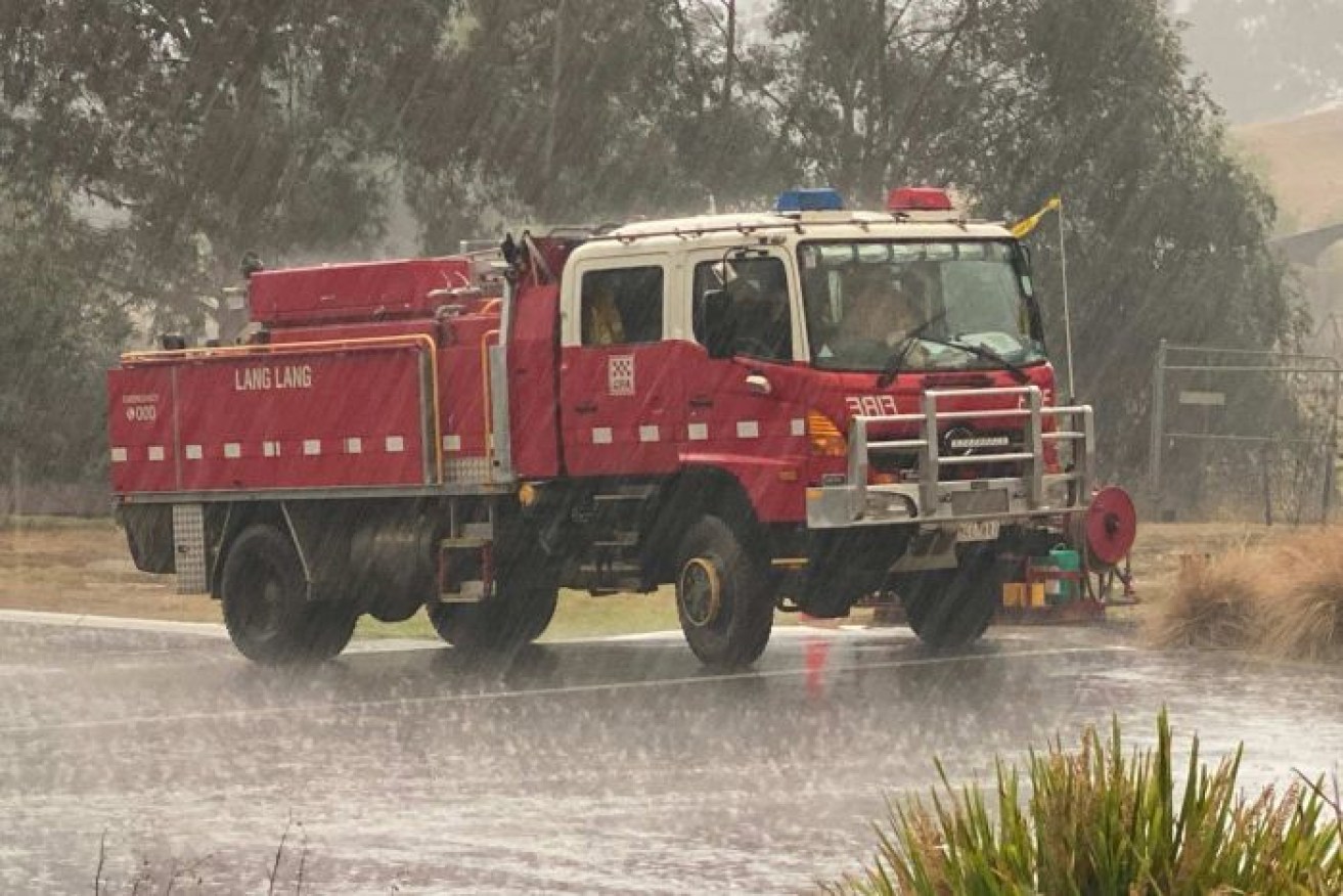
More rain would be welcome on fire grounds after they got a sprinkling last week. Photo: CFA
Finally, there’s a forecast to get excited about.
Widespread rainfall is expected for the east coast of the country, including the firegrounds, starting tomorrow and lasting into the weekend.

Keep your fingers crossed, Australia, there just might be some rain on the way. Infographic: Bureau of Meteorology
Falls of 5 millimetres to 10mm are forecast for much of the east coast, with the potential of 50mm if you happen to be under a thunderstorm.
Rainfall would be welcome, but it may yet be a double-edged sword.
Where is the rain coming from?
The tropical north has been getting a deluge over the last few days as the monsoon trough has finally made its way down to Australia.

It has been a wet start to the year for cattle stations in the Kimberley and East Pilbara thanks to Ex-TC Blake. Photo: Courtney Walker
Sarah Scully, extreme weather forecaster at the Bureau of Meteorology (BOM), said the monsoon had brought an increase in humidity and available moisture to mainland Australia.
“As well as that, over eastern Australia we’ve had a high-pressure system that’s been sitting in the Tasman Sea,” she said.
“That’s been directing a moist onshore flow over the eastern part of Australia over the last few days.”
All of this moisture is forecast to collide with a deepening low-pressure trough.
The trough is expected to develop over central to western New South Wales, extending right down into Victoria over the coming days, according to Ms Scully.
What’s exciting is that the trough is forecast to be really slow moving, bringing plenty of opportunities for showers and storms as it slowly makes its way across to the east coast.
“So with the instability that’s created by this trough, plus the increased humidity, all those ingredients go together to create a really unstable environment with increased showers and thunderstorms,” Ms Scully said.
Will it be enough to put the fires out?
Even the Rural Fire Service is getting hopeful about the predicted rainfalls.
If this @BOM_NSW rainfall forecast comes to fruition then this will be all of our Christmas, birthday, engagement, anniversary, wedding and graduation presents rolled into one. Fingers crossed. #NSWRFS #nswfires pic.twitter.com/R9VfD0bqu2
— NSW RFS (@NSWRFS) January 12, 2020
Ms Scully said there was potential for fires that were beneath a thunderstorm to be contained by that rainfall.
“The best-case scenario, with the ongoing showers and storms from Wednesday onwards, is that they can really impact and help to extinguish some of the fires,” she said.
But keep those fingers crossed, because the hit-and-miss nature of thunderstorms means that the rainfall can vary a lot.
“It’s very likely that there’s going to be an increase in shower and thunderstorm activities,” Ms Scully said.
“What’s difficult to say is the exact location where the heaviest totals are going to be accumulated.”
As well as possibly dampening the fires, this rain could reduce the chance of new ones forming.
Over the last few months a series of dry frontal systems have swept across parched southern Australia, generating dry lightning and new fires.
“At least with this heavy rainfall the ground will be more moist and it’ll be harder to ignite,” Ms Scully said.
She said lightning associated with the storms over the next few days would be accompanied by rain, so less of a risk of starting fires.
But there are definitely hazards associated with this next batch of weather.
“There’s a risk of flash flooding and landslips with any heavy bursts of rainfall, particularly over the dry and burnt out areas of NSW and eastern Victoria,” Ms Scully said.
“They are particularly vulnerable because the recent fires have cleared the groundcover, which allows or accelerates the runoff and also reduces the absorption by vegetation.”
The runoff can also contain contaminants and be a risk for tanks and waterways.
Just a small amount of rainfall can also be a hazard to firefighters because it can make conditions slippery, making operating heavy machinery in the bush difficult and reducing the effectiveness of backburning.
According to Ms Scully, strong winds associated with the thunderstorms also increases the risk that trees, recently weakened by fire, could fall.
Not everyone will be getting the rain
Sorry South Australia and southern Western Australia, it looks like you will be missing out on this round of rainfall.
But once the trough has gone through there could potentially be even more good news in its wake.
The trough bringing rain to the east is expected to move off the coast by Monday or Tuesday, but the next system to move across the country could also bring rain, thanks to Tropical Cyclone Claudia, currently spinning off the West Australian coast.
“It’s still a number of days away, but it does look like some of the moisture from Tropical Cyclone Claudia may be picked up by the passage of a frontal system,” Ms Scully said.
Perhaps it is worth crossing your toes, too.
Drought-breaking rain?
Before you get your hopes up, no, it is not nearly enough rain to be drought-breaking.
“Look, Australia’s been in a really long drought and it’s going to take many above-average rainfall events for it to really have any impact on the drought conditions,” Ms Scully said.

The outlook for the next three months is mostly neutral, with a low chance above average rainfall for parts of the east coast. Infographic: Bureau of Meteorology
This week’s rain is very welcome but with no strong indication of wetter-than-average conditions on the long-term outlook we aren’t out of the woods yet.


