Storm front: 500km line of dust envelopes Sydney

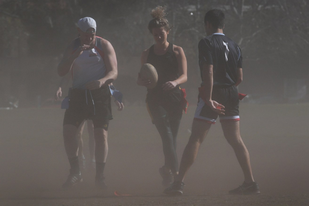
The imminent dust storm may cause flight delays. Photo: Getty
Sydney was blanketed in dust for much of Thursday as a 500-kilometre storm stretching almost the length of NSW bore down on the city.
The dust storm had already reduced visibility to just metres in far western NSW, including at Darling River and Broken Hill, on Wednesday.
On Thursday, strong winds from the low pressure system that whipped up masses of dirt across drought-stricken NSW was heading steadily towards the coast.
She’s a bit dusty in Sydney! #DustStorm #Sydney #SydneyDustStorm #drought pic.twitter.com/svpmFilfO1
— mOrganics-kim.morgan (@mOrganicsKim) November 22, 2018
Satellite images showed the massive line of dust, which could be seen from the Victorian border, through Canberra and up to Queensland. In Sydney and Canberra, and in other towns in the storm’s path, skyline views were wiped out and landmarks blanketed in a gloomy dusk.
“It’s a huge system,” Bureau of Meteorology duty forecaster Anita Pyne said.
“We’re expecting the dust to gradually increase over the next few hours, with the main band of dust to hit Sydney through the middle of the day or early afternoon. So the worst visibility is yet to occur.”
By early Thursday afternoon (ADST), the air quality in north-west Sydney, the Central Coast and the Upper Hunter Valley was described as “hazardous”. Everyone was urged to remain inside as much as possible.
#Dust over #ACT this morning associated with strong winds from a cold front. However current and continuing #Showers will help to reduce dust particle concentrations in the area. To see the radar head over to https://t.co/6yXpCfgrXD pic.twitter.com/IdofDvAzA2
— Bureau of Meteorology Australian Capital Territory (@BOM_ACT) November 21, 2018
The weather also caused delays at Sydney Airport.
“Due to weather conditions, single runway operations are currently in effect. International and Domestic terminals are experiencing some flight delays. Please contact your airline for more information,” a spokesman tweeted on Thursday afternoon.
Ms Pyne said it was not uncommon for inland parts of NSW to experience small-scale dust storms, but one this size was unusual.
“It’s unusual for dust events to happen on the coast because we’re so much further away from that dust over the western NSW basin, and we’ve got the Great Dividing Range in the way,” she said.
The dust was expected to keep sweeping east, and might not clear the coast until Friday.
The storm prompted an early warning from NSW Health about air quality. It has urged children, older people and those with respiratory conditions to take extra care.
“If possible, stay in air-conditioned premises where filtration systems can help to reduce dust particles in the air,” environmental health director Richard Broome said.
“Dust may aggravate existing heart and lung conditions and cause symptoms like eye irritation and cough.”
Meanwhile, snow was forecast for parts of the Snowy Mountains above 1100 metres and Victoria was also enduring a wintery blast.
Things are looking a lot like Winter at Falls Creek this morning! 😍😍https://t.co/eHdyiyYkMY pic.twitter.com/nboUi3n069
— SNOWSEARCH australia (@SNOWSEARCH_aus) November 21, 2018
“Everything’s happening,” Ms Pyne said.
Wild weather was also being felt elsewhere in Australia. Late on Thursday afternoon, severe wind caused blackouts across Adelaide’s power network, leaving nearly 40,000 properties without power.
The South Australian Country Fire Service and State Emergency Service responded to nearly 500 severe incidents during the storm, mostly involving trees and downed power lines.
South-east Queensland was also feeling the impact of the front, with a warning from the weather bureau of gusts of wind of up to 90km/h.
Meanwhile, in some parts of Western Australia, some parts of the state were declared to be at catastrophic risk of a fire.
🔥A Catastrophic Fire Danger Rating is in place for the Midwest Gascoyne today.🔥
Fires that start under these extreme conditions are likely to be so fierce that even a well-prepared and actively defended home may not survive.
ℹ️ Find all warnings at https://t.co/v9GYWWrJRJ pic.twitter.com/QvkjEWrxzW
— DFES (@dfes_wa) November 22, 2018
Other areas had severe or extreme risks. The weather bureau said this was to do a deepening low pressure system that would bring hot, dry and windy conditions across much of inland WA.
